


- True-color (960 kB JPEG)
- Temperature (1.1 MB JPEG)
Urbanization does more than just transform ecosystems, it also changes fundamental variables that influence weather and climate, such as land surface temperature, surface roughness, and evaporation. For many years scientists have documented the changes in land surface temperature that result when natural or agricultural vegetation is replaced with parking lots, streets, buildings. Urban areas can be up to 8 degrees warmer than surrounding suburban or natural landscapes. This urban heat island affects not only the amount of energy a city needs to keep its residents cool and comfortable, but it also appears to influence where and how much it rains in the vicinity.
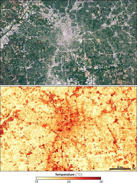
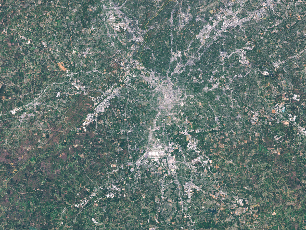
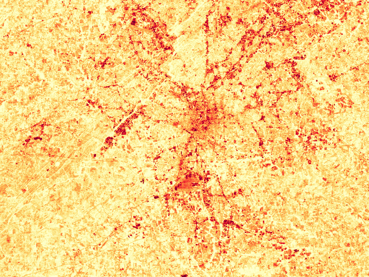
This pair of Landsat satellite images provides two views of urban Atlanta, Georgia, on September 28, 2000; the urban core is in the center of the images. The top image is a photo-like view of the area, where trees and other vegetation are green, roads and dense development appear cement-gray, and bare ground appears tan or brown. The bottom image is a land surface temperature map, in which cooler temperatures are yellow and hotter temperatures are red. Because vegetation cools the surface through evaporation of water, the most densely vegetated areas (darkest green in top image) are the coolest areas (palest yellow in bottom image). Where development is densest, the land surface temperature is near 30 degrees Celsius (86 degrees Fahrenheit).
Scientists suspect that the urban heat island effect may be one of the factors behind several studies showing that cities influence rainfall in their surrounding area. The heating of the surface and the overlying air creates instability in the atmosphere that encourages air to rise. As it rises, it cools, and water vapor condenses into rain that falls downwind of the city. Since the launch of the Tropical Rainfall Measuring Mission satellite—a joint NASA-Japanese mission—, observations of rainfall in the Studies of regional rainfall patterns in the U.S. Southeast have shown that rainfall downwind of major urban areas can be as much as 20 percent greater than it is upwind areas. To learn more about how the urban heat island and other city traits such as pollution and topography may be influencing rainfall, please read the feature story Urban Rain.
References & Resources
NASA images by Marit Jentoft-Nilsen, based on Landsat-7 data.
None


