

September 30, 2011
Vast Area Burned in Australia
A wet summer set the stage for one of the most severe fire seasons northern Australia has experienced in recent years. In late 2010 and early 2011, a strong La Niña dominated weather patterns and brought drenching rain and floods to Australia. Thick grass grew in response to the rain, providing more fuel for fires than at any time in the past 30 years, said Australian news reports.
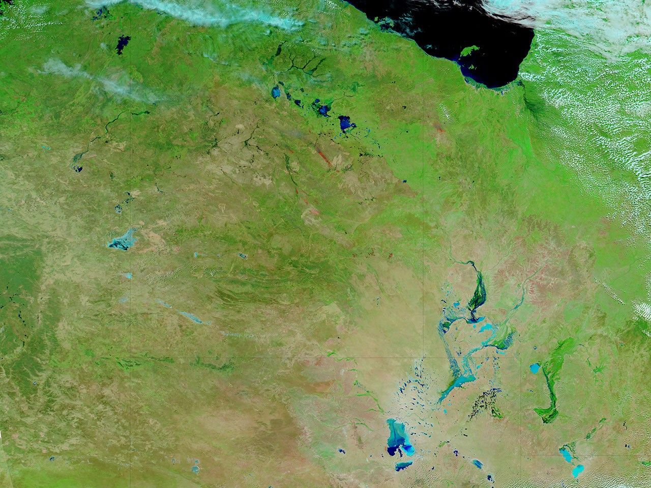
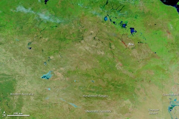
Fall and winter brought drier weather that dried out the grasses and primed them for fire. The top image shows the first of the fires burning in Northern Territory on April 11, 2011. The image is from the Moderate Resolution Imaging Spectroradiometer (MODIS) on NASA’s Aqua satellite and includes a combination of both visible and infrared light. The fire is marked in red and the burned land around it is dark red. The grass-covered land is bright green, while more sparsely vegetated areas are tan. Water—blue and black in this image—lingers in seasonal rivers and lakes.
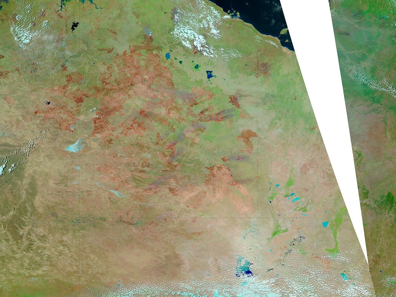
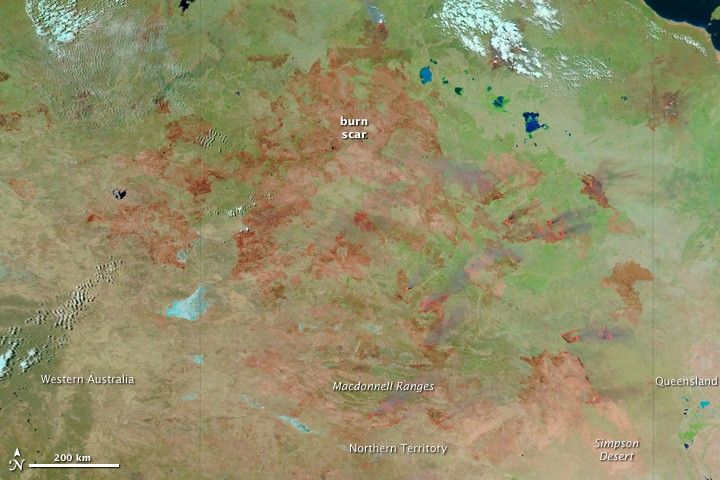
By September 30, 2011 (lower image), fire has transformed the landscape. Freshly burned land is brick red and active fires are marked in red. Older burn scars, which are lighter pink, cover a vast area. Some of the unburned land along the lower edge of the image (Australia’s red desert interior) also has a slight pink tint. After a dry winter, the green around the burned areas is faded. The grass is less lush than in the summer and fall.
The burned area covers much of Northern Territory and expands into Western Australia, Queensland, and South Australia, just beyond the lower edge of the image. According to the Herald Sun, the fires have burned more than 130,000 square kilometers (50,000 square miles), an area about the size of England or the U.S. state of Louisiana. ABC News reports nearly 150,000 square kilometers (58,000 square miles) burned in September. During the last extreme fire season in Australia’s interior (1974-75), 117 million hectares (1,170,000 square kilometers or 452,000 square miles) burned, said the Sydney Morning Herald.
On September 30, authorities were monitoring 21 large fires, though the satellite image shows many more. The fire season is likely to continue for several months.
References & Resources
- Herald Sun. (2011, September 30). Weather helps Northern Territory firefighters. Accessed September 30, 2011.
- Horn, A. (2011, September 30). Territory road travelers warned of smoke hazards. ABC News. Accessed September 30, 2011.
- Neil, M. (2011, September 29). Drought, rain, and now grass fire risk. Sydney Morning Herald. Accessed September 30, 2011.
- Northern Territory Government. (2011, September 30). North Australia fire information. Accessed September 30, 2011.
NASA images courtesy the MODIS Rapid Response Team at NASA GSFC. Caption by Holli Riebeek.