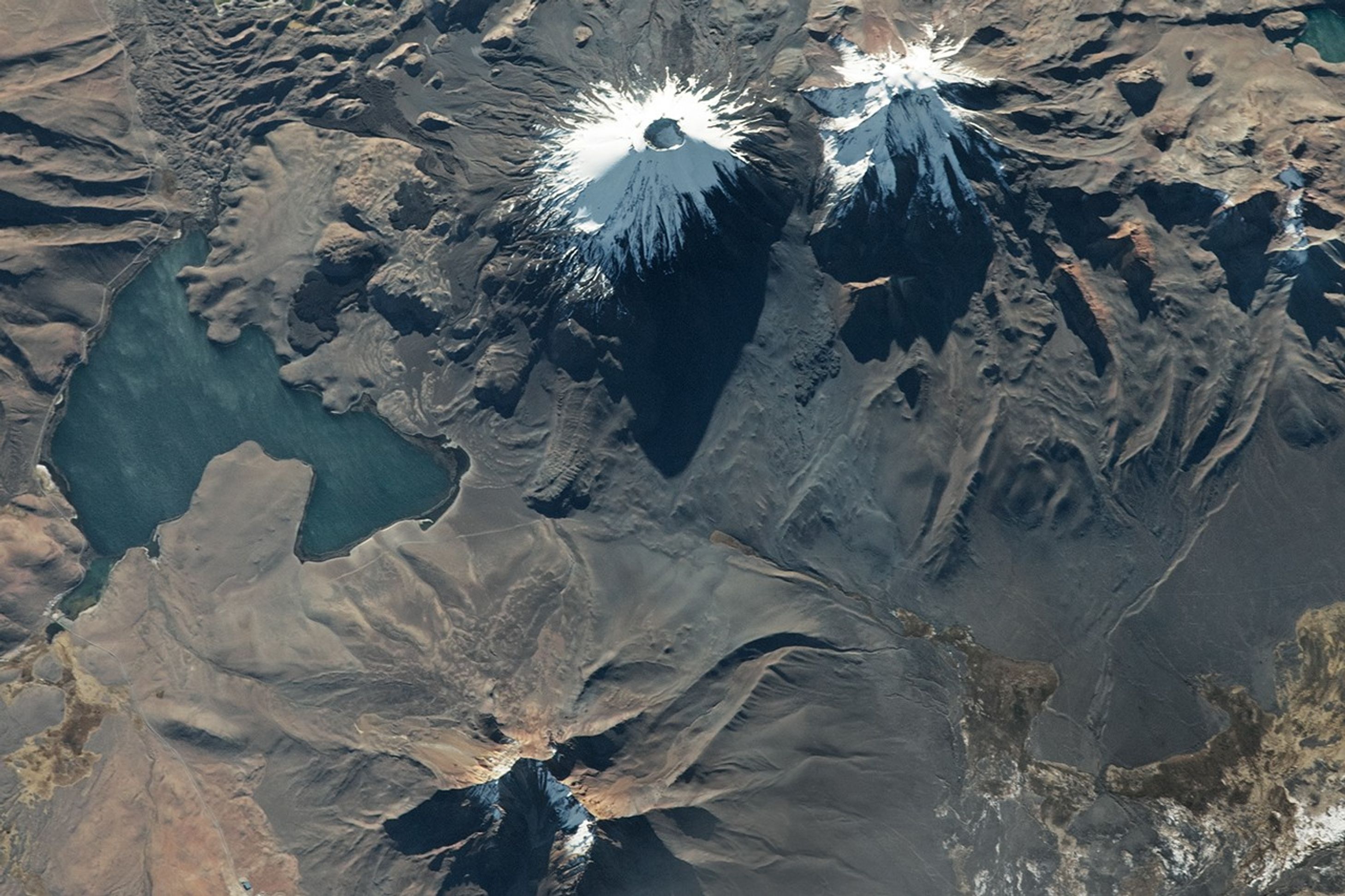
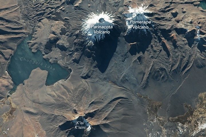
An astronaut aboard the International Space Station took this nadir (downward-looking) photograph of Parinacota and Pomerape, twin volcanoes in the Andes Mountains. The volcanoes compose the Nevados de Payachata volcanic group and form part of the border between Chile and Bolivia. Illuminated by early evening sunlight, the snow- and glacier-capped peaks cast long, distinct shadows.
Both Parinacota and Pomerape are stratovolcanoes with summits reaching approximately 20,500 feet (6,250 meters) above sea level. Parinacota is the younger of the two volcanoes and its summit has a distinctive circular 1,000-foot (300-meter) diameter crater. It is also the more historically active of the two, with its most recent eruption estimated to have occurred within the past 2,000 years. Both volcanoes formed during the Pleistocene Epoch, but while Parinacota displays a fresh conical shape, the flanks of Pomerape have been eroded over time into deep valleys.
A collapse of the western flank of Parinacota approximately 8,000 to 12,000 years ago produced a debris avalanche that traveled down the slope of the volcano into a neighboring valley. The avalanche material is visible as a hummocky mass in the top-left part of the image. This kind of flank collapse is similar to what occurred at Mount St. Helens on May 18, 1980.
The avalanche material blocked the valley and caused Chungará Lake to form where debris obstructed water channels. Following the flank collapse, subsequent volcanic activity reconstructed the conical form of Parinacota.
K’isi K’isini is another Pleistocene-age volcano located southeast of the Nevados de Payachata Range. The mountain is within the Sajama National Park of Bolivia, which is the country’s oldest national park, established in 1939.
References & Resources
Astronaut photograph ISS069-E-23100 was acquired on June 19, 2023, with a Nikon D5 digital camera using a focal length of 400 millimeters. The image was provided by the ISS Crew Earth Observations Facility and the Earth Science and Remote Sensing Unit, Johnson Space Center. The image was taken by a member of the Expedition 69 crew . It has been cropped and enhanced to improve contrast, and lens artifacts have been removed. The International Space Station Program supports the laboratory as part of the ISS National Lab to help astronauts take pictures of Earth that will be of the greatest value to scientists and the public, and to make those images freely available on the Internet. Additional images taken by astronauts and cosmonauts can be viewed at the NASA/JSC Gateway to Astronaut Photography of Earth. Caption by Cadan Cummings, Jacobs, JETS II Contract at NASA-JSC.