


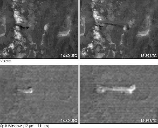
Lascar volcano, in northern Chile, erupted on July 20, 2000, sending ash40,000 feet into the air. These images from the NOAA GeostationaryOperational Environmental Satellite (GOES) show the ash cloud as it bleweast.
The top images use the GOES visible light band. The dark ash clouddoes not stand out well from the Earth’s surface. To enhance theappearance of the ash cloud, we compared the two GOES thermal infraredchannels in the bottom images (called the split window technique).Silcate particles in the ash cloud absorbmore 11 µm radiation than 12 µm radiation, so the ash isemphasized when one channel is subtracted from the other. This techniqueis especially useful in overcast conditions, because water droplets andice crystals absorb less in the 11 µm channel than the 12micro;m channel.
References & Resources
Image by Marit Jentoft-Nilsen, NASA GSFC Visualization Analysis Lab, based on data provided by NOAA.
None


