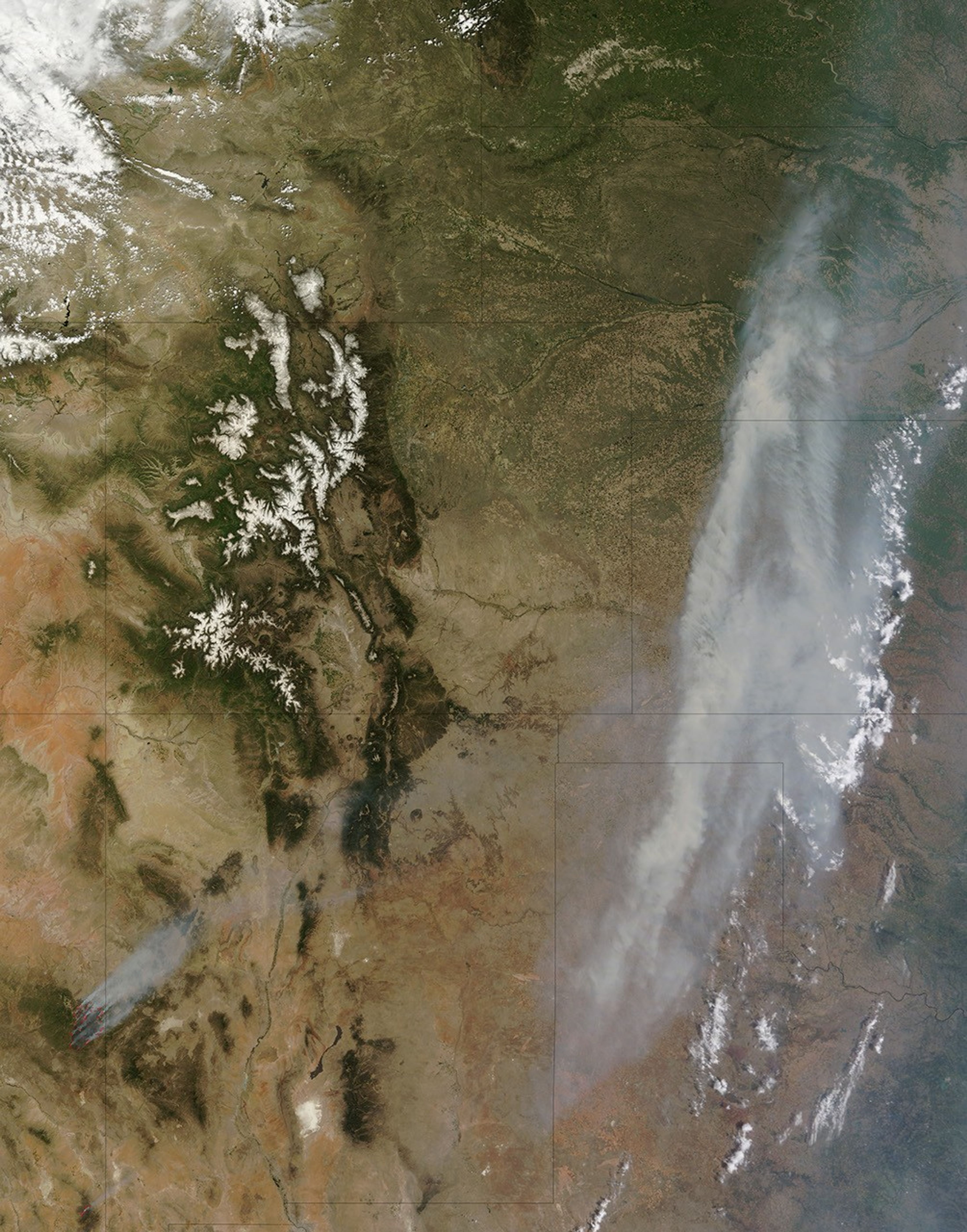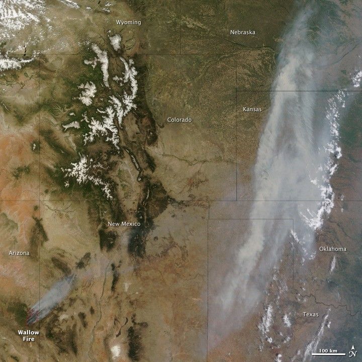
High winds and low humidity fueled extreme fire behavior as the Wallow Fire continued to consume acres of forested land in the mountains of eastern Arizona on June 7, 2011. By the end of the day, the fire had burned 311,481 acres (487 square miles), up 77,959 acres (122 square miles) from the previous day. As the fire raged, smoke poured across the United States, clouding skies over the Midwest.
At 11:05 a.m. Arizona time, when the Moderate Resolution Imaging Spectroradiometer (MODIS) on the Terra satellite acquired this image, a dense band of smoke was visible from Texas to Nebraska. Winds had blown the smoke eastward from New Mexico, Colorado, and Wyoming, where it hovered on June 5.
The thick smoke in this image was only part of the smoky haze plaguing the continental United States in early June. According to the U.S. Air Quality “Smog Blog,” smoke from fires in Arizona and New Mexico extended through Kansas and into to the Great Lakes region, affecting air quality for large areas east of the Rocky Mountains.
The Wallow Fire started on May 29, 2011. As of June 7, 2011, the fire had damaged one structure, destroyed 10 others, and threatened 343 more. As sheriffs expanded evacuation orders, fire-control crews undertook controlled burns to establish line of protection around the fire. At that time, however, the fire remained completely uncontained.
References & Resources
- InciWeb. (2011, June 7). Wallow Fire. Accessed June 8, 2011.
- U.S. Air Quality. (2011, June 7). Smoke from Arizona and New Mexico fires. Accessed June 8, 2011.
NASA image courtesy Jeff Schmaltz, MODIS Rapid Response Team at NASA GSFC. Caption by Holli Riebeek and Michon Scott.