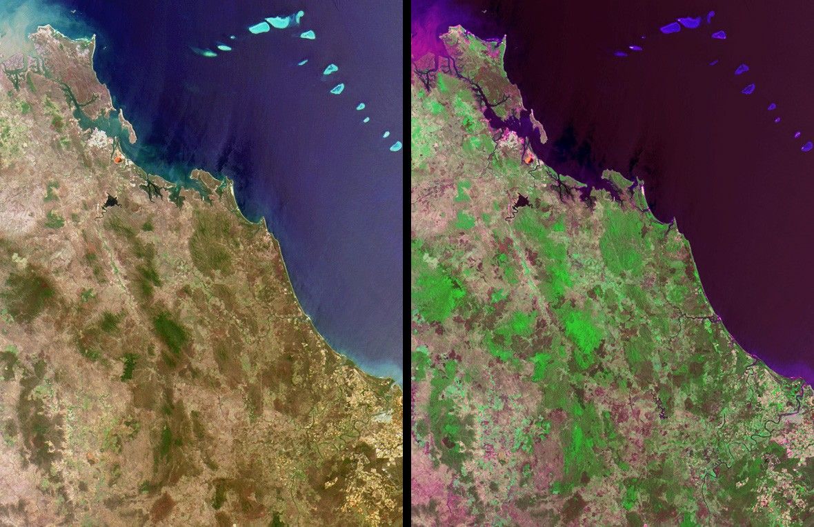

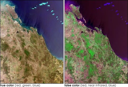
Here’s another chance to play geographical detective! Theseimages from the Multi-angle Imaging SpectroRadiometer (MISR) werecaptured by the instrument’s nadir camera on November 19, 2001,and show a natural-color (left) and false-color (right) view of a 157kilometer x 210 kilometer area. The natural-color image is composed ofdata from the camera’s red, green, and blue bands. In thefalse-color view, the green channel has been replaced with data from thecamera’s near-infrared band. This emphasizes the appearance ofvegetation. North is toward the top.
Use any reference materials you like to answer the following 5questions:
- In the upper left-hand corner, the ocean waters exhibit a murkyappearance due to a large amount of sediment being discharged from ariver mouth. For whom is the river named and what office did this personhold?
- In the upper left-hand quadrant of these images, a small, brightreddish-orange feature is apparent near the coast in both the naturaland false-color views. The cause of this reddish-orange feature is:
- The recurrence of a bloom of red algae.
- An abundance of naturally-occurring iron deposits.
- A modern art installation financed by a private consortium.
- Waste from a mineral manufacturing and refining process.
- A distinctively-shaped, dark-colored reservoir with a sinewy riverat one end is located to the south of the aforementioned reddish-orangefeature. This reservoir is the main water supply for a nearby industrialand urban region. When these images were acquired, the water levelwithin this reservoir was at about 45% of total capacity. Over the nextsix months, did the water level in the reservoir rise or fall?
- A small seaside town within the image area (situated just overhalfway down this length of coastline) was named to commemorate the yearwhen a group of global explorers first set foot in this locality. Whatis the name of the town?
- In the lower right-hand quadrant of these images, a large windingriver flows through an agricultural region. Endemic only to the upperreaches of this and a few other nearby rivers is an endangered fish witha peculiar anatomical characteristic. Name the fish.
Quiz Rules
E-mail your answers, name (initialsare acceptable if you prefer), and your hometown by Tuesday, October 29,to suggestions@mail-misr.jpl.nasa.gov
Answers will be published on the MISR web site (http://www-misr.jpl.nasa.gov) in conjunction withthe next weekly image release. The names and home towns of respondentswho answer all questions correctly by the deadline will also bepublished in the order responses were received. The first 3 people onthis list who are not affiliated with NASA, JPL, or MISR and who did notwin a prize in the last quiz will be sent a print of the image.
A new "Where on Earth...?" mystery appears as the MISR "image of theweek" approximately once every two months. A new image of the week isreleased every Wednesday at noon Pacific time on theMISR home page.
References & Resources
Image courtesy NASA/GSFC/LaRC/JPL, MISR Team.