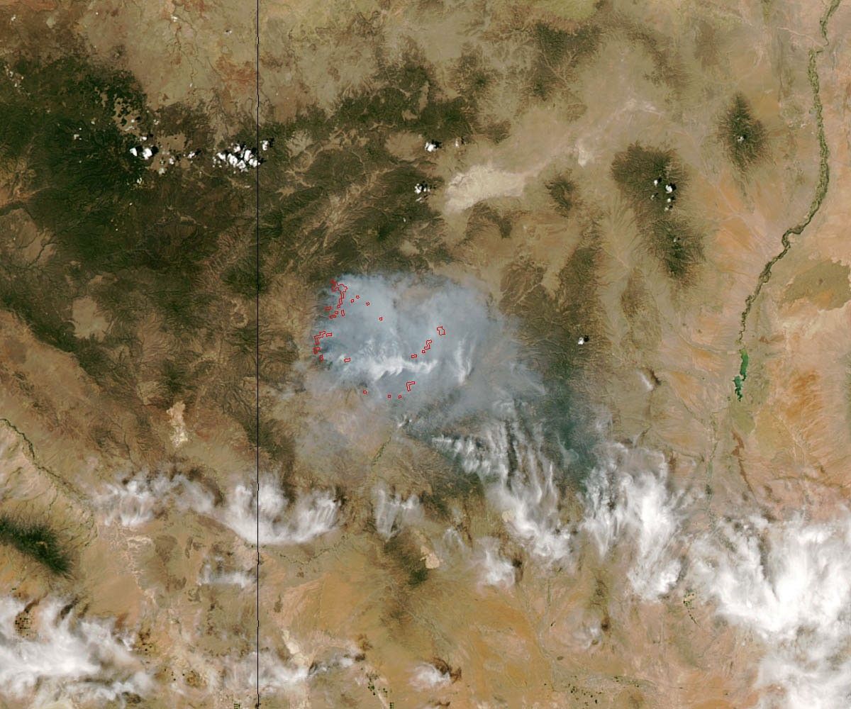


By June 4, 2012, the Whitewater-Baldy Complex Fire in southwestern New Mexico had burned 241,701 acres (978 square kilometers) of Gila National Forest. For comparison, all five boroughs of New York City cover 755 square kilometers. The blaze was 18 percent contained on June 4. Firefighters expected that the fire, already the largest on record in New Mexico, would continue burning for many days.
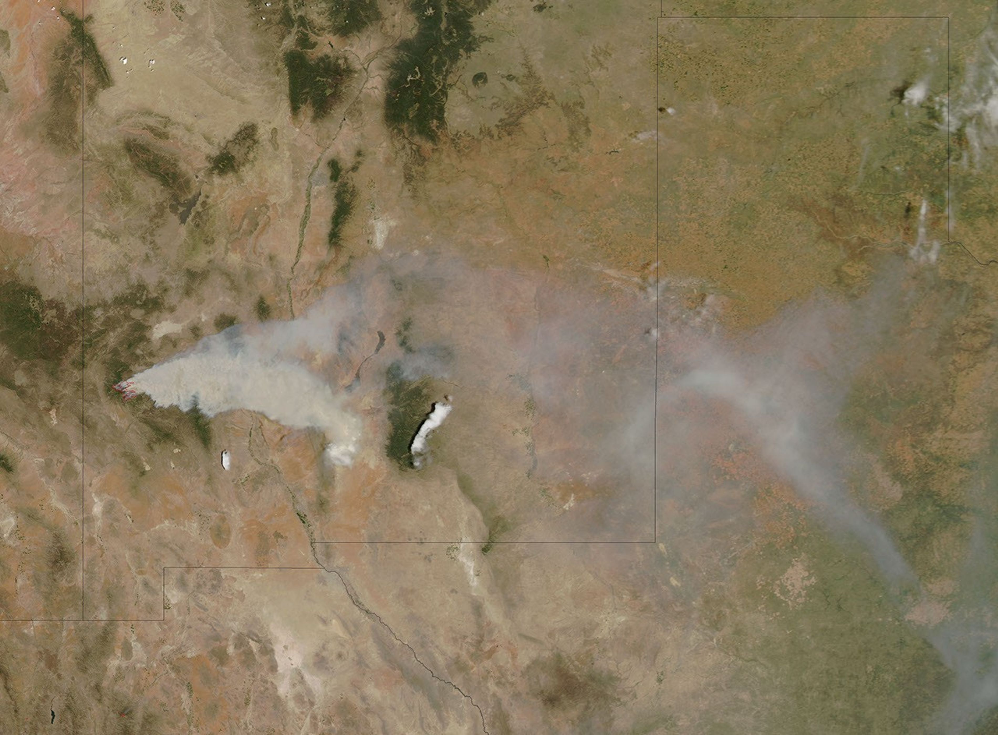
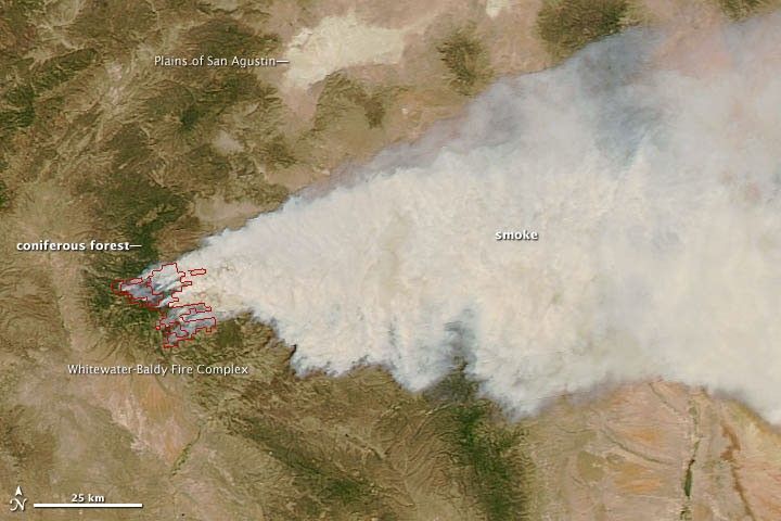
The Baldy fire began on May 9 due to a lighting strike. About 10 miles to the northwest, lightning started the Whitewater fire on May 16. The two fires burned separately for a week, but they merged on May 23. After that, the combined fire burned in fits and starts. Strong winds caused the fire to spread rapidly on May 23, a day the fire expanded by 48,911 acres. The blaze tore through thick coniferous forests that day, sending thick plumes of smoke aloft. The Moderate Resolution Imaging Spectroradiometer (MODIS) instrument on NASA’s Aqua satellite captured the lower view of the smoke on May 23.
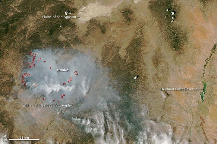
The pace of the growth slowed to 11,674 acres on May 24, but on May 26 the fire expanded another 40,137 acres. After that, the pace of growth declined. On June 1, the fire grew 11,078 acres; on June 2nd, 13,988 acres. When the MODIS acquired the top view of the fire on June 3, the smoke was much thinner and hotspots (shown by red outlines) were significantly smaller and more widely spaced.
Vegetation type can affect the type of smoke a fire emits. Grassland fires, for example, tend to burn rapidly and to generate black smoke rich in black carbon particles. Forest fires, and fires occurring when the moisture is high, tend to create thicker smoke, often brown or white, a combination of organic carbon particles and condensed water. Gila National Forest contains both forests and grasslands.
Images of the fire taken from the ground are available on Gila National Forest's flickr page.
References & Resources
- International Business Times. (2012, June 3). Gila, Monster Of a Wildfire Still Being Battled in N.M. Accessed June 4, 2012
- Inciweb. (2012, June 4) Whitewater Baldy Complex. Accessed June 4, 2012.
NASA image courtesy Jeff Schmaltz, LANCE MODIS Rapid Response Team, Goddard Space Flight Center. Caption by Adam Voiland.