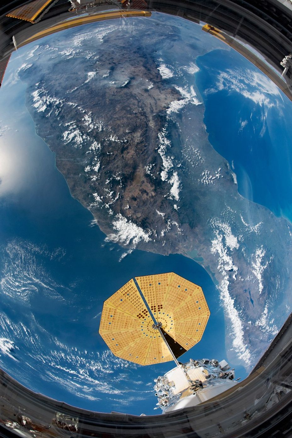


An astronaut onboard the International Space Station (ISS) took this photograph using a short camera lens, capturing almost all of Mexico in one shot. The wide field of view is framed by the center window of the ISS Cupola module and includes a solar array of the Northrop Grumman Cygnus cargo spacecraft.
This view encompasses most of Mexico’s mountain ranges and long coastlines, though details like individual cities and volcanoes are not readily distinguishable. Active volcanoes like Popocatepetl, Colima, and Pico de Orizaba are nestled throughout the Sierra Madre del Sur mountains. Mexico City, which is regularly rattled by earthquakes, sits at the foot of Popocatepetl.
Different climate zones are broadly visible in the image. On the southern coast facing the Gulf of Mexico, the climate is tropical and wet. Forests and coastal plains appear with a slight green tone. Looking inland, clouds tend to form around the mountains and often shroud tall volcanic peaks. The lighter toned tan-brown terrain of the interior is mostly desert country that stretches north across the U.S.-Mexico border.
Further Reading
- Giddings, L. at al. (2005) Standardized Precipitation Index Zones for México. Atmósfera 18 (1).
- NASA Earth Observatory (2016, January 25) Volcanic Activity at Popocatepetl.
- NASA Earth Observatory (2011, February 10) Pico de Orizaba, Mexico.
- NASA Earth Observatory (2011, January 22) Eruption of Colima Volcano.
References & Resources
Astronaut photograph ISS062-E-112947 was acquired on March 23, 2020, with a Nikon D5 digital camera using a 16 millimeter lens and is provided by the ISS Crew Earth Observations Facility and the Earth Science and Remote Sensing Unit, Johnson Space Center. The image was taken by a member of the Expedition 62 crew. The image has been cropped and enhanced to improve contrast, and lens artifacts have been removed. The International Space Station Program supports the laboratory as part of the ISS National Lab to help astronauts take pictures of Earth that will be of the greatest value to scientists and the public, and to make those images freely available on the Internet. Additional images taken by astronauts and cosmonauts can be viewed at the NASA/JSC Gateway to Astronaut Photography of Earth. Caption by Andrea Meado, Jacobs/JETS Contract at NASA-JSC.