















September 4, 2002
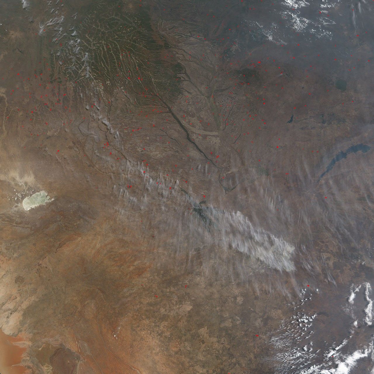
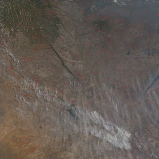
On September 4, 2002, the Moderate Resolution Imaging Spectroradiometer (MODIS) on NASA’s Terra satellite captured this image of the southern Africa burning season still going strong. Numerous fires were detected by MODIS and are indicated with red dots. In the top half of the image is Zambia, and the Zambezi River can be seen as a prominent green line running southeast out of the upper left. In the southern past of the image are Botswana (left) and Zimbabwe (right). Beneath the streamers of smoke and cloud, the lush vegetation of the Okavango River Delta in Botswana is partially visible.
References & Resources
Image by Jesse Allen, based on data from the MODIS Rapid Response Team at NASA-GSFC