


Full-size image
MODIS 250 m Resolution (3.8 MB JPEG)
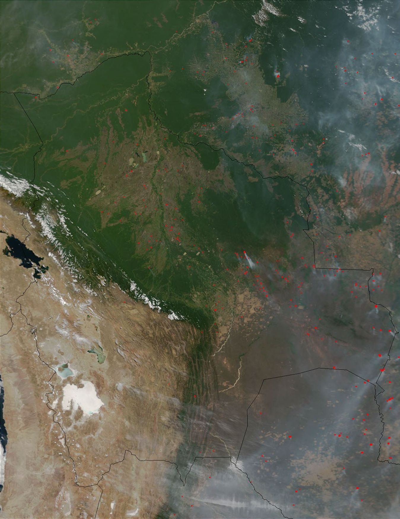
This true-color image from NASA's Terra satellite shows a staggering number of fires burning across central South America on September 19, 2001. As a result, there is a thick layer of smoke and haze blanketing much of southwestern Brazil, Bolivia, and Paraguay. The image serves as a reminder that the forests in this region are increasingly under pressure from ongoing human deforestation.
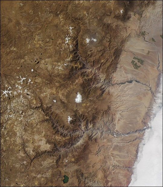
The area shown in this Moderate-resolution Imaging Spectroradiometer (MODIS) image spans from just south of the Amazon Basin (about 10 degrees south latitude at the northern edge) across Bolivia and Paraguay and into the northern plains of Argentina (at the southern edge). Lake Titicaca is visible at the left center edge of the scene. Scanning eastward, the scene extends into Brazil's Mato Grosso Plateau.
The full image (link upper right) shows the scene at a resolution of 1 km per pixel, whereas MODIS has the capacity to make measurements at a resolution of 250 m per pixel (see link above for full-size image).
References & Resources
Image courtesy Jacques Descloitres, MODIS Land Rapid Response Team at NASA GSFC


