


![Request for Information – Potential [Placeholder for Prize]](https://assets.science.nasa.gov/dynamicimage/assets/science/psd/solar/2023/09/s/solarsystem_0.jpg?w=1024)


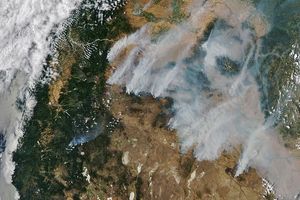
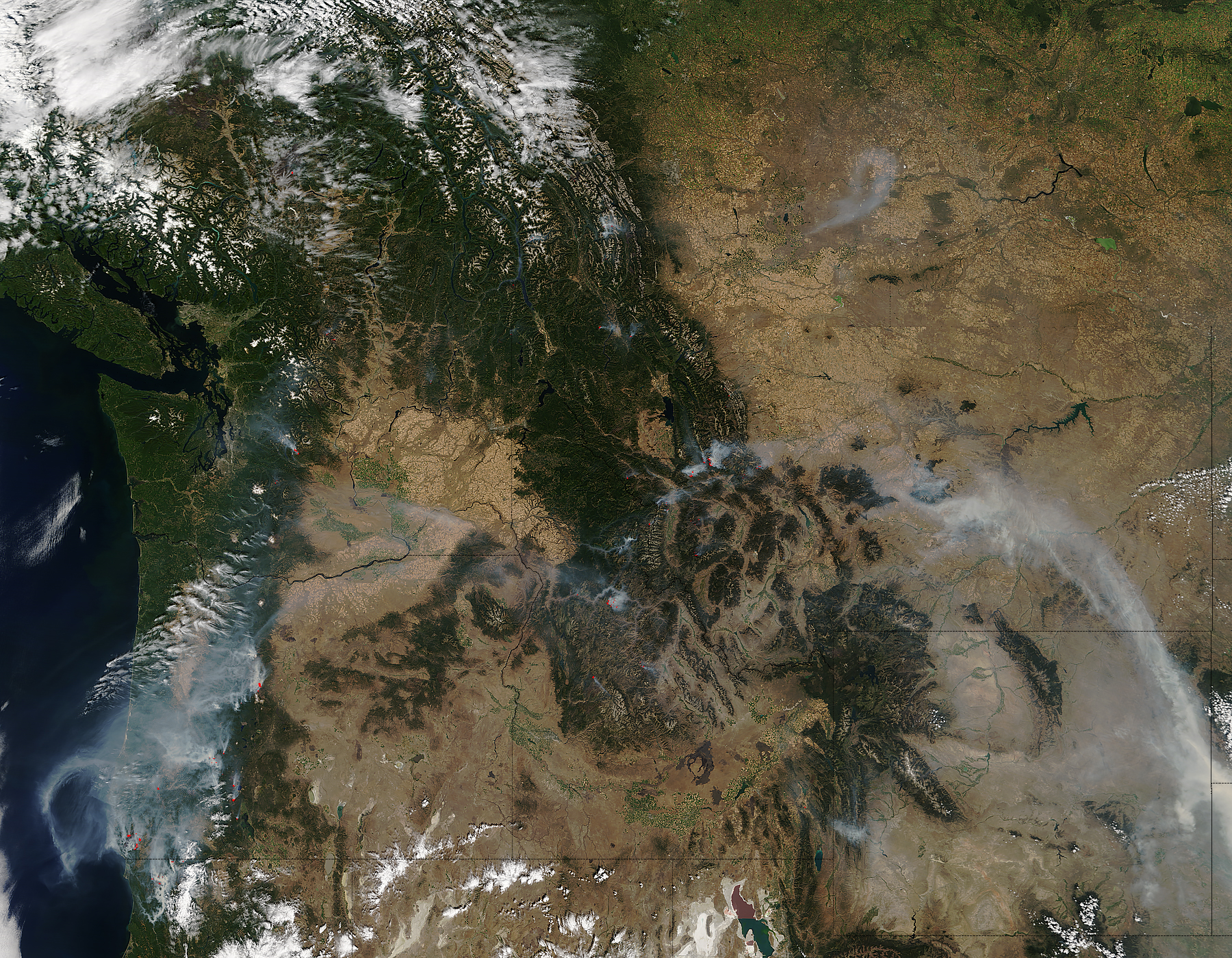
On August 27, 2017, the Moderate Resolution Imaging Spectroradiometer (MODIS) on NASA’s Terra satellite captured this image of wildfires burning in Oregon. Actively burning areas, detected by the thermal bands on MODIS, are outlined in red.
The Chetco Bar fire is the largest in the scene, visible in the southwest corner of the state. At the time, the fire had already burned the more than 100,000 acres since lightning ignited it in mid-July. The fire spurred evacuations, and the smoke has caused air in the region to be categorized “unhealthy.”
Other fires burned in the Willamette and Umpqua national forests. So far, these fires have burned a smaller area compared to Chetco Bar, but each is contributing to the regional blanket of smoke. Hot and dry conditions (due to a high-pressure system) have played a role in the fire activity, according to the Oregon Department of Forestry.
According to the National Interagency Fire Center, 51 large fires have burned almost 600,000 acres in the U.S. West in 2017. View the wide image to see smoke from fires in California, Idaho, Washington, and Montana.
References & Resources
- InciWeb (2017, August 28) Oregon Incidents. Accessed August 28, 2017.
- National Interagency Coordination Center (2017, August 28) Incident Management Situation Report. Accessed August 28, 2017.
- Oregon Department of Forestry (2017, August 27) Wildfire - Oregon Dept of Forestry. Accessed August 28, 2017.
- USDA Forest Service, Remote Sensing Applications Center (2017, August 28) Active Fire Map. Accessed August 28, 2017.
NASA image by Jeff Schmaltz, LANCE/EOSDIS Rapid Response. Caption by Kathryn Hansen.


