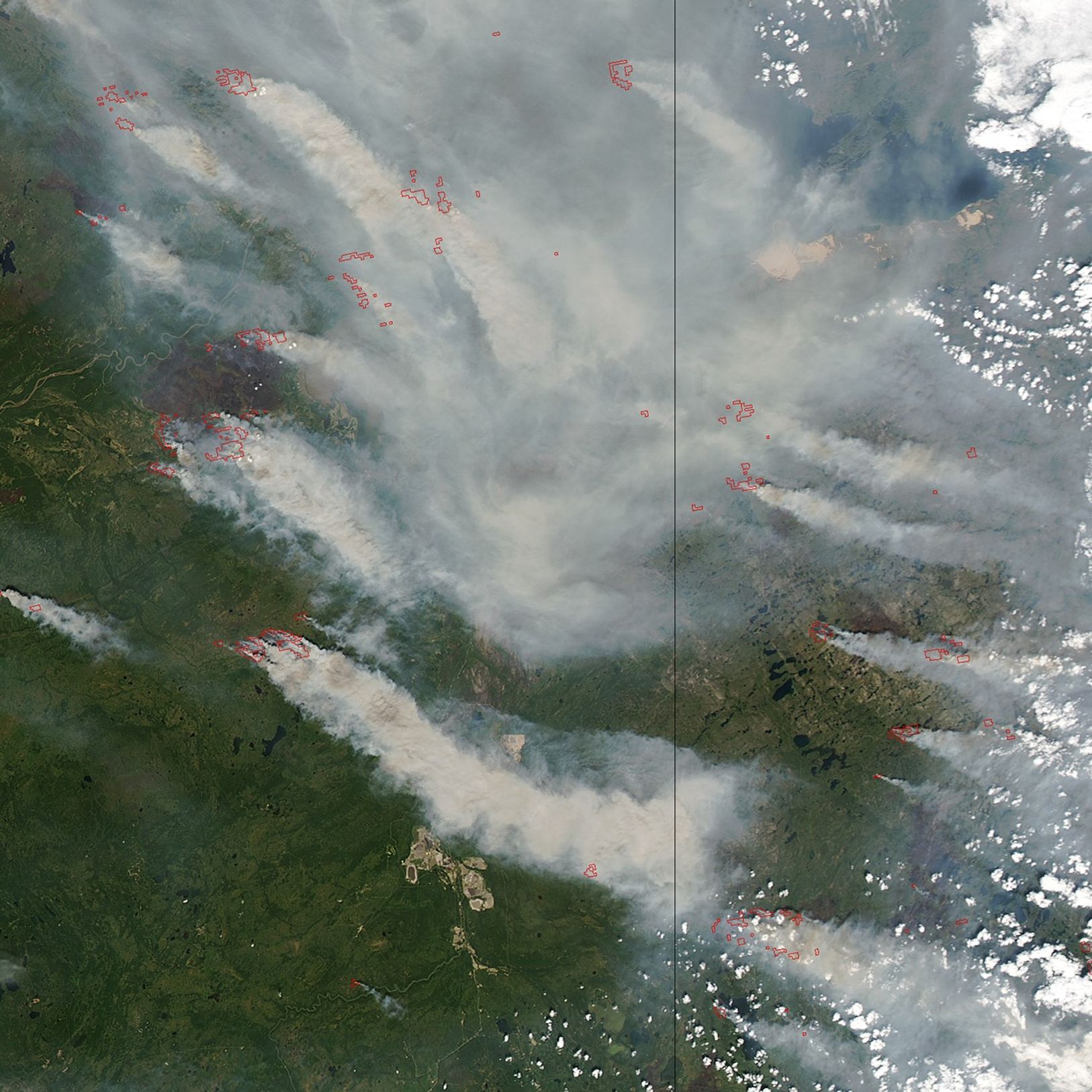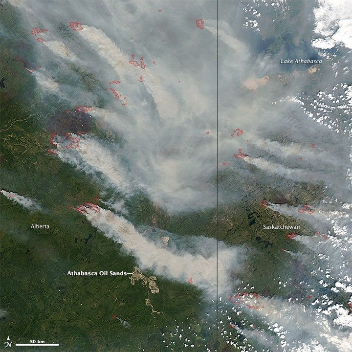
On June 28, 2015, the Moderate Resolution Imaging Spectroradiometer (MODIS) on NASA’s Aqua satellite captured this image of wildfires burning in Alberta, north of the Athabasa oil sands. Actively burning areas, detected by the thermal bands on MODIS, are outlined in red, while forests appear dark green.
A combination of lightning, parched forests, and strong winds have fueled the fires. According to the Canadian government, 27 uncontrolled fires were burning in Alberta on June 28. Thirty were burning to the east in Saskatchewan.
The 2015 fire season got off to an unusually early start in Canada when blazes broke out in the Northwest Territories, British Columbia, and Alberta in late May. The Edmonton Sun has called the current fire season Alberta’s worst in five years.
References & Resources
- Canadian Interagency Forest Fire Center (2015, June 29) National Wildland Fire Situation Report: June 28, 2015, 15:00 Hours. Accessed June 29, 2015.
- Edmonton Sun (2015, June 28) Alberta experiencing one of the worst wildfire seasons in the past five years. Accessed June 29, 2015.
NASA image courtesy Jeff Schmaltz, LANCE/EOSDIS MODIS Rapid Response Team at NASA GSFC. Caption and image cropping by Adam Voiland.