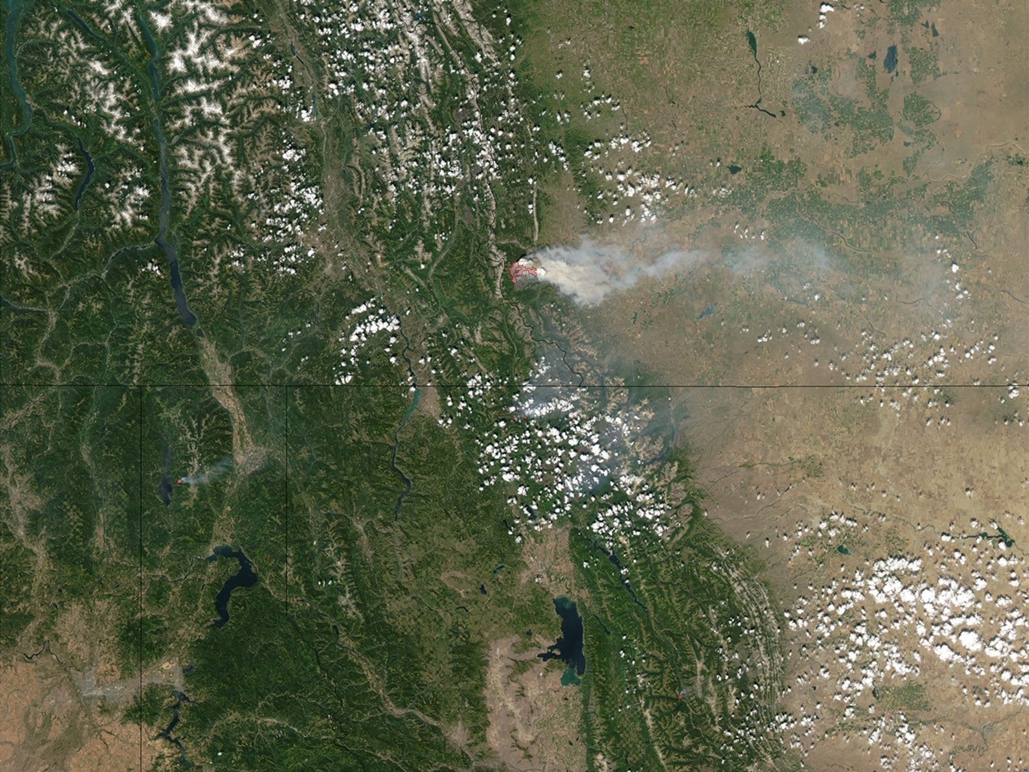
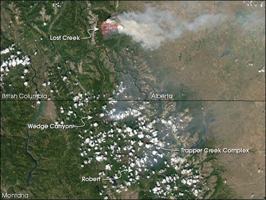
Fast-moving forest fires continued to race through terrain at the front range of the Rocky Mountains in northern Montana (bottom right) and Alberta, Canada (top right), on July 27, 2003. In Montana, the fires (marked in red) forced thousands of tourists and staff to evacuate Glacier National Park (image center) late last week, while in Canada, the blaze forced many residents of the small community of Hillcrest to evacuate their homes on Sunday. The Canadian fire, moving through the forest at almost 27 meters per minute (89 feet per minute), doubled in size to 70 square kilometers (17,297 acres). This image of the fires was captured on Sunday, July 27, 2003, by the Moderate Resolution Imaging Spectroradiometer (MODIS) on the Aqua satellite. Active fire detections made by MODIS are oultined in red.
By July 28, 2003, the Wedge Canyon Fire had spread over 76 km2 (18,850 acres), the Trapper Creek fire had covered 67 km2 (16,500 acres,) and the Robert Fire had consumed 38 km2 (9,310 acres). The Lost Creek Fire in Alberta, Canada had burned over 70 km2 (17,300 acres).
References & Resources
Image courtesy Jacques Descloitres, MODIS Land Rapid Response Team at NASA GSFC