![Request for Information – Potential [Placeholder for Prize]](https://assets.science.nasa.gov/dynamicimage/assets/science/missions/a-step/FFR_Earth_Background_20251120%20.png?w=1024)


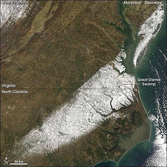
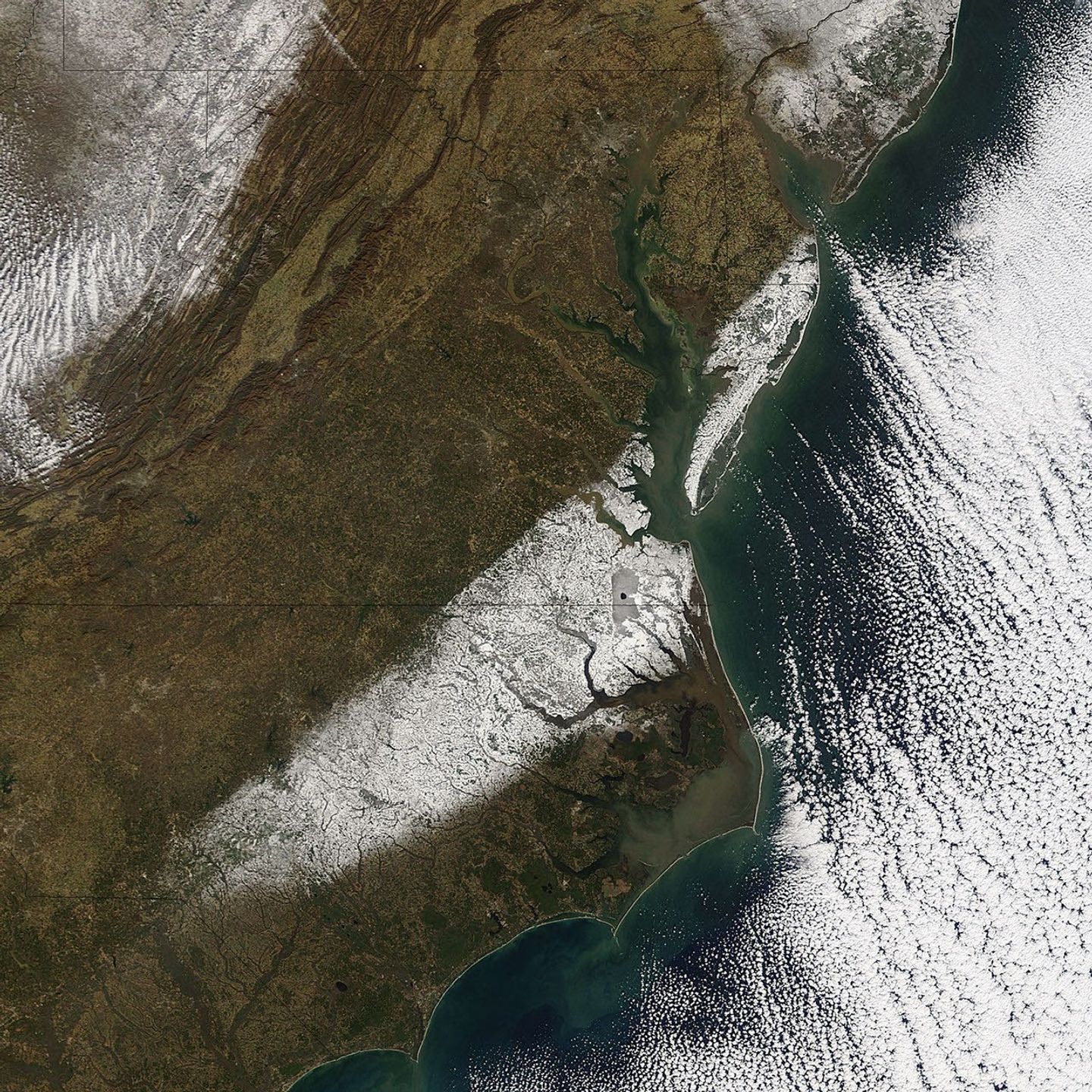
A post-Christmas winter storm brought ice and snow to South Carolina, North Carolina and Virginia, closing Interstate 95, stranding motorists and airline passengers, and knocking out power to more than 20,000 households. This image captured by the Moderate Resolution Imaging Spectroradiometer (MODIS) on NASA’s Terra satellite on December 27, 2004, shows the aftermath of the storm, a white swath of snow stretching from the southern edge of North Carolina, through Virginia, and across the Chesapeake Bay into Maryland and Delaware. The snow highlights the Great Dismal Swamp, which straddles the state line between Virginia and North Carolina. In the upper left corner, snow covers the mountainous terrain of West Virginia.
The high-resolution image provided above is 500 meters per pixel. The MODIS Rapid Response System provides this image at
References & Resources
NASA image courtesy the MODIS Rapid Response Team, NASA-Goddard Space Flight Center