


- Photo-like image (505 kB JPG)
- Infrared-enhanced image (1.9 MB JPG)
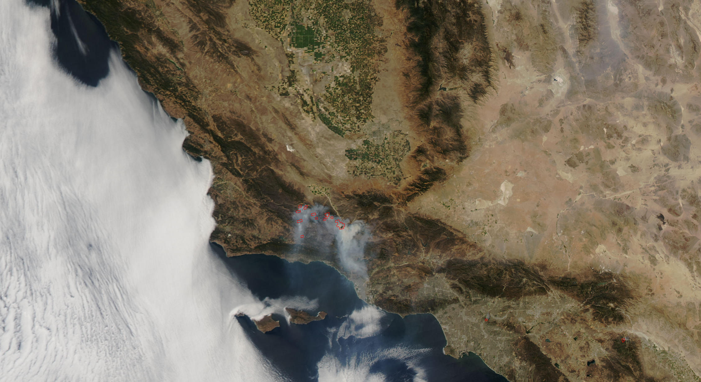
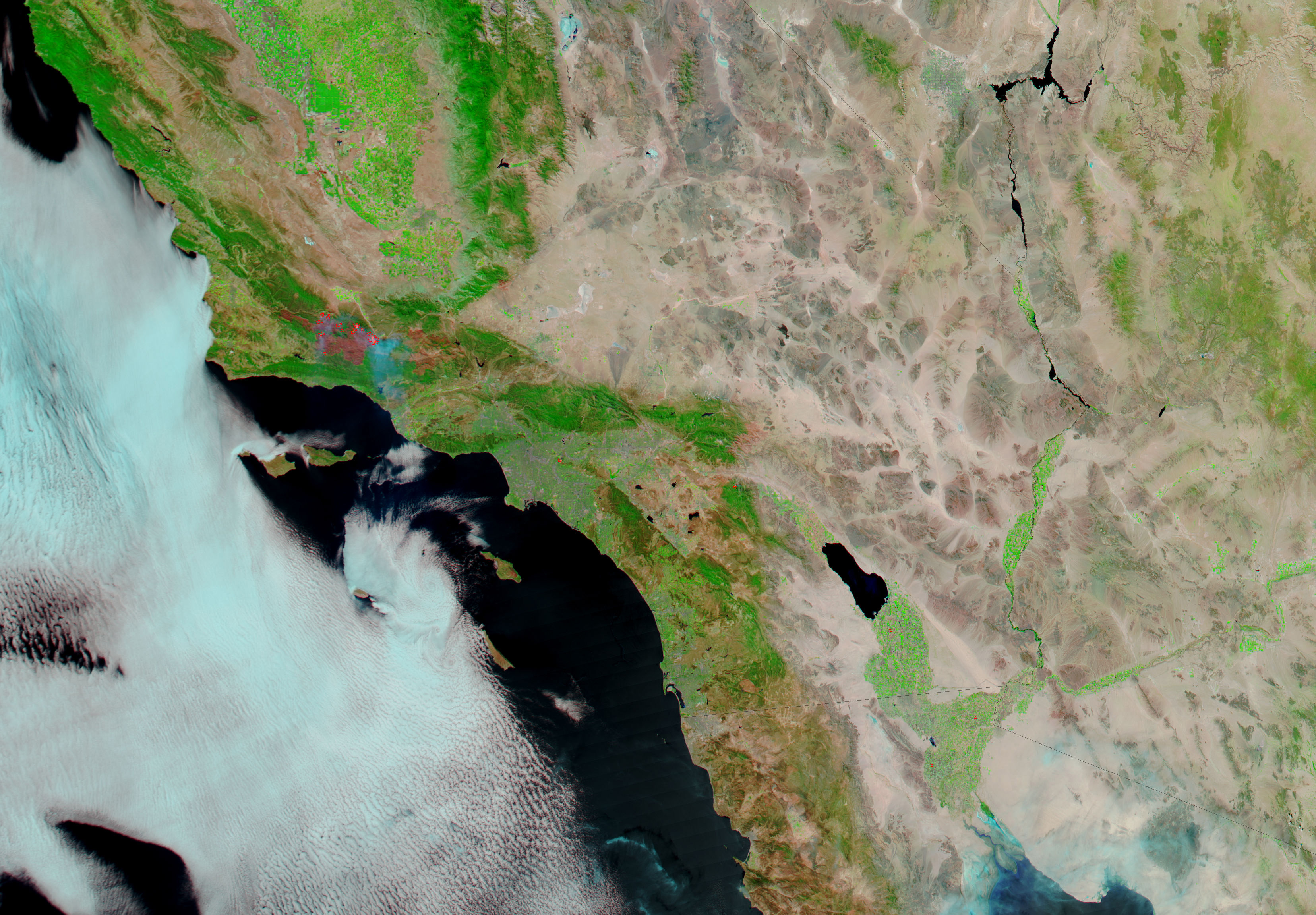
Since July 4, 2007, the Zaca Fire has been burning through chaparral and woodlands in Southern California’s Los Padres National Forest. These images of the fire were captured by the Moderate Resolution Imaging Spectroradiometer (MODIS) on NASA’s Aqua satellite on August 21, at which point the fire had burned over 220,000 acres. According to the daily report from the National Interagency Fire Center on August 22, the fire was about 79 percent contained.
The pair of images includes a photo-like version of the scene (top) and an infrared-enhanced version (bottom) that highlights burned areas (brick red) and possible open flames (bright pink). In both images, areas in which the sensor detected active fire are outlined in red. In the photo-like images, the dry vegetation of the chaparral landscapes of Southern California appear greenish brown, bare ground is light tan, and irrigated farmland is bright green.
The large images provided above have a spatial resolution (level of detail) of 250 meters per pixel. The MODIS Rapid Response Team provides twice-daily images of the region in additional resolutions.
References & Resources
NASA image courtesy the MODIS Rapid Response Team, Goddard Space Flight Center


