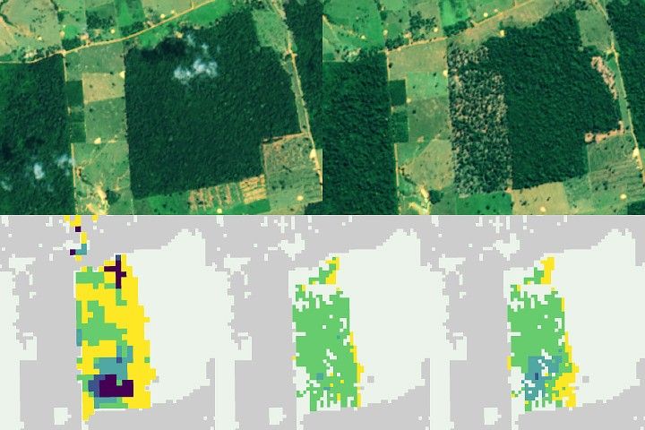
NASA uses satellite lidar technology to study Earth’s forests, key carbon sinks. The GEDI mission maps forest height and biomass from the International Space Station, while ICESat-2 fills polar data gaps. Together, they enable a first-of-its-kind global biomass map, guiding smarter forest conservation and carbon tracking.
1 min read
From Space to Soil: How NASA Sees Forests
Share
Details
Last Updated
Jun 17, 2025
Editor
Earth Science Division Editorial Team