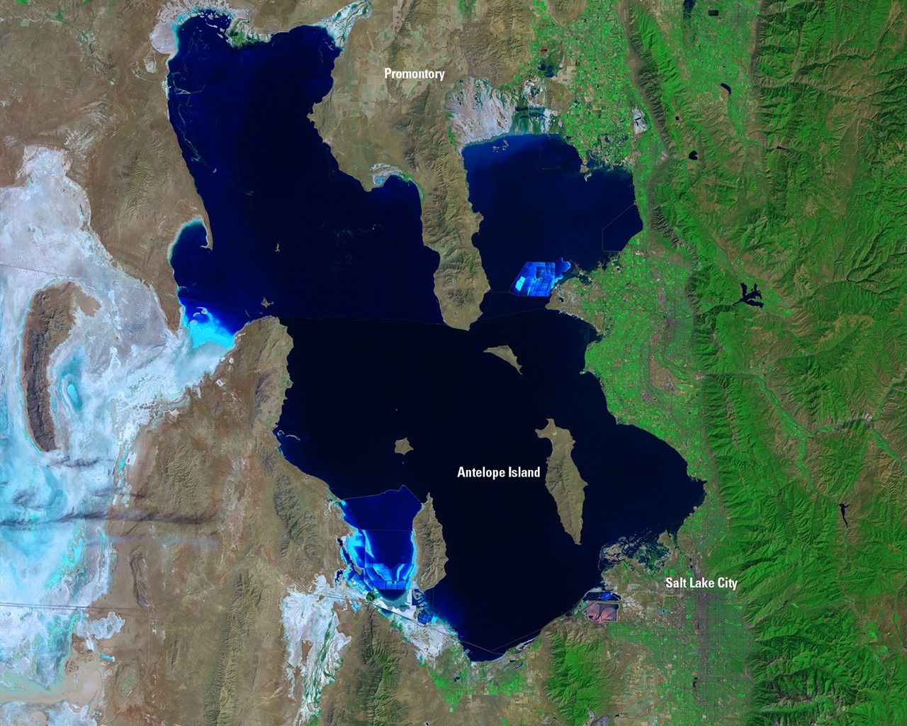
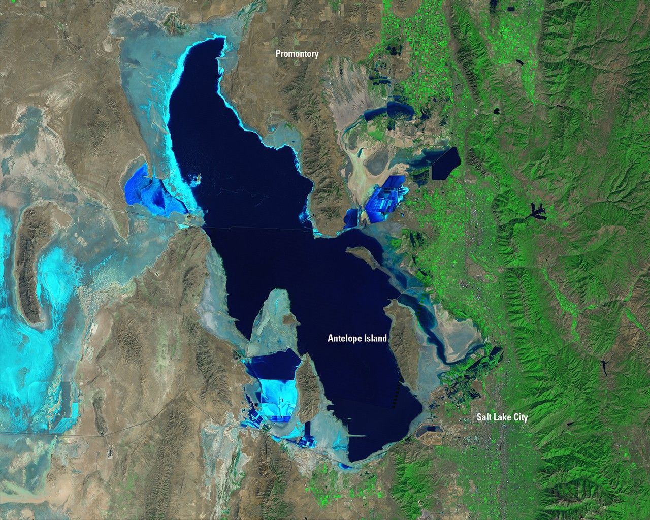
Suggested Searches

1 min read

Great Salt Lake shrinkage, Utah

before
after
Dramatic change in the area of the Great Salt Lake over the past 25 years. The lake was filled to near capacity in 1985 because feeder streams were charged with snowmelt and heavy rainfall. In contrast, the 2010 image shows the lake shriveled by drought. The Promontory Peninsula (protruding into the lake from the top) is surrounded by water on three sides in the first image, but is landlocked on its eastern side in the second. Similarly, Antelope Island was encircled by water in 1985, but was connected to marshy areas in 2010. Mosaics of four satellite images were used to illustrate the changes over the full lake area.   Images taken by the Thematic Mapper sensor aboard Landsat 5. Source: USGS Landsat Missions Gallery, "Great Salt Lake—1985-2010," U.S. Department of the Interior / U.S. Geological Survey.

Before and After

Great Salt Lake shrinkage, Utah

August 1985 - September 2010

Dramatic change in the area of the Great Salt Lake over the past 25 years. The lake was filled to near capacity in 1985 because feeder streams were charged with snowmelt and heavy rainfall. In contrast, the 2010 image shows the lake shriveled by drought. The Promontory Peninsula (protruding into the lake from the top) is surrounded by water on three sides in the first image, but is landlocked on its eastern side in the second. Similarly, Antelope Island was encircled by water in 1985, but was connected to marshy areas in 2010. Mosaics of four satellite images were used to illustrate the changes over the full lake area. Images taken by the Thematic Mapper sensor aboard Landsat 5. Source: USGS Landsat Missions Gallery, "Great Salt Lake—1985-2010," U.S. Department of the Interior / U.S. Geological Survey.

Downloads

Image 1

JPEG

(3 MB)

Image 2

JPEG

(3 MB)