Suggested Searches

4 min read

NASA Announces New System to Aid Disaster Response

Contents

In early May, widespread flooding and landslides occurred in the Brazilian state of Rio Grande do Sul, leaving thousands of people without food, water, or electricity. In the following days, NASA teams provided data and imagery to help on-the-ground responders understand the disaster’s impacts and deploy aid.

Building on this response and similar successes, on June 13, NASA announced a new system to support disaster response organizations in the U.S. and around the world.
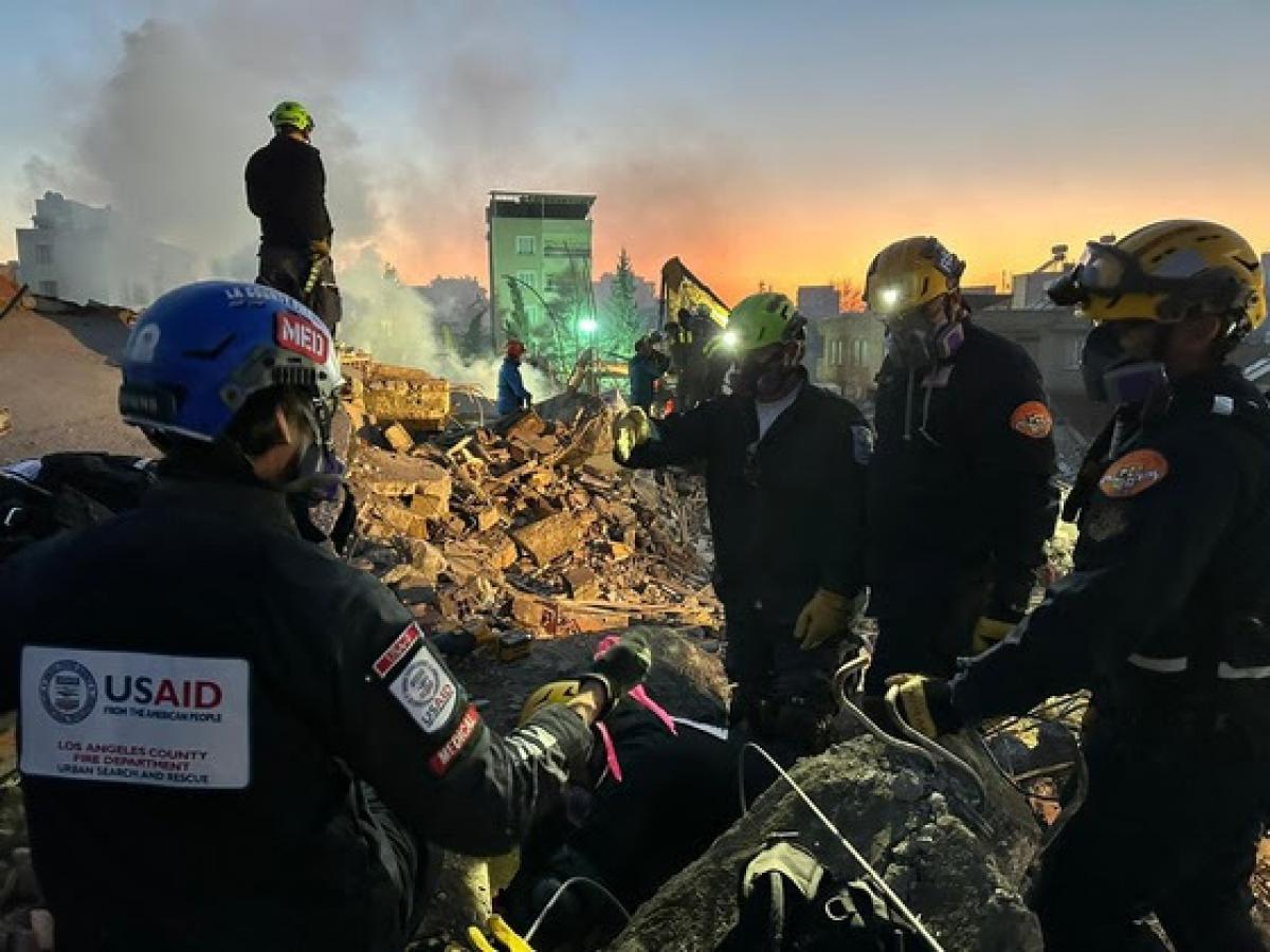
people in search-and-rescue attire stand among rubble
Members of the Los Angeles County Fire Department’s Urban Search and Rescue team in Adiyaman, Turkey (Türkiye), conducting rescue efforts in the wake of powerful earthquakes that struck the region in February 2023. NASA provided maps and data to support USAID and other regional partners during these earthquakes.
USAID

“When disasters strike, NASA is here to help — at home and around the world,” said NASA Administrator Bill Nelson. “As challenges from extreme weather grow, so too does the value of NASA’s efforts to provide critical Earth observing data to disaster-response teams on the frontlines. We’ve done so for years. Now, through this system, we expand our capability to help power our U.S. government partners, international partners, and relief organizations across the globe as they take on disasters — and save lives.”

The team behind NASA’s Disaster Response Coordination System gathers science, technology, data, and expertise from across the agency and provides it to emergency managers. The new system will be able to provide up-to-date information on fires, earthquakes, landslides, floods, tornadoes, hurricanes, and other extreme events.

man in blue suitcoat at podium with microphone
NASA Administrator Bill Nelson delivers remarks during an event launching a new Disaster Response Coordination System that will provide communities and organizations around the world with access to science and data to aid disaster response, Thursday, June 13, 2024, at the NASA Headquarters Mary W. Jackson Building in Washington.
NASA/Bill Ingalls

“The risk from climate-related hazards is increasing, making more people vulnerable to extreme events,” said Karen St. Germain, director of NASA’s Earth Science Division. “This is particularly true for the 10% of the global population living in low-lying coastal regions who are vulnerable to storm surges, waves and tsunamis, and rapid erosion. NASA’s disaster system is designed to deliver trusted, actionable Earth science in ways and means that can be used immediately, to enable effective response to disasters and ultimately help save lives.”

Agencies working with NASA include the Federal Emergency Management Agency, the National Oceanic and Atmospheric Administration (NOAA), the U.S. Geological Survey, and the U.S. Agency for International Development — as well as international organizations such as World Central Kitchen.

“With this deliberate and structured approach, we can be even more effective in putting Earth science into action,” said Josh Barnes, at NASA’s Langley Research Center in Hampton, Virginia. Barnes manages the Disaster Response Coordination System.

NASA Disasters Team Aiding Brazil

When the floods and landslides ravaged parts of Brazil in May, officials from the U.S. Southern Command — working with the U.S. Space Force and Air Force, and regional partners — reached out to NASA for Earth-observing data.

before
after
satellite view of a brown-hued waterway near an urban area
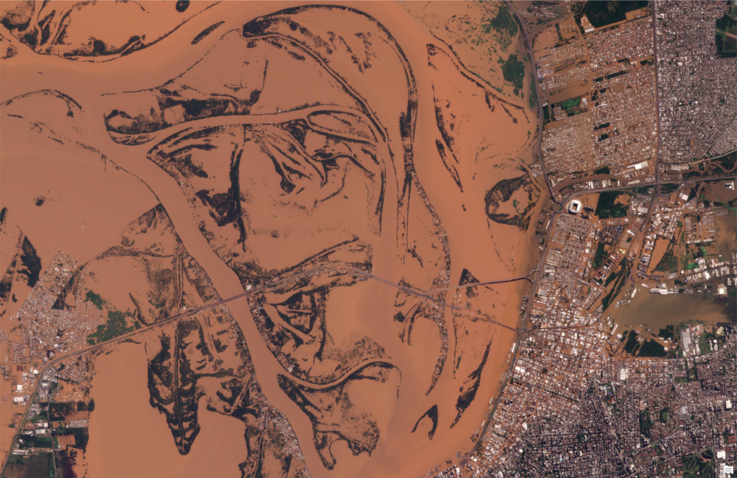
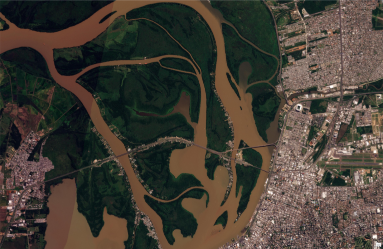
Pre-event satellite imagery from before widespread flooding in Porto Alegre, Brazil, in May 2024. This image is from April 20, 2024.
satellite image showing brown-hued and flooded waterway near urban area
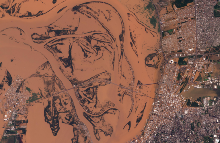
Post-event satellite imagery showing widespread flooding in Porto Alegre, Brazil, in May 2024. This image is from May 6, 2024.
before
after

Before and After

Flooding in Porto Alegre, Brazil

Spring 2024

Pre- and post-event satellite imagery shows widespread flooding in Porto Alegre, Brazil, in May 2024. The left image is from April 20, 2024, and the right image is from May 6, 2024. Credits: NASA; includes copyrighted material from Planet Labs PBC, used with permission. All rights reserved.

Downloads

Image 1 (JPG) ### KB

PNG

(3 MB)

Image 2 (JPG) ### KB

PNG

(3 MB)

NASA’s response included maps of potential power outages from the Black Marble project at NASA’s Goddard Space Flight Center in Greenbelt, Maryland. Disaster response coordinators at NASA Goddard also reviewed high-resolution optical data — from the Commercial Smallsat Data Acquisition Program — to map more than 4,000 landslides.

Response coordinators from NASA’s Jet Propulsion Laboratory and the California Institute of Technology, both in Southern California, produced flood extent maps using data from the NASA and U.S. Geological Survey Landsat mission and from ESA’s (the European Space Agency) Copernicus Sentinel-2 satellite. Response coordinators at NASA’s Johnson Space Center in Houston also provided photographs of the flooding taken by astronauts aboard the International Space Station.

Building on Previous Work

The Brazil event is just one of hundreds of responses NASA has supported over the past decade. The team aids decision-making for a wide range of natural hazards and disasters, from hurricanes and earthquakes to tsunamis and oil spills

“NASA’s Disasters Program advances science for disaster resilience and develops accessible resources to help communities around the world make informed decisions for disaster planning,” said Shanna McClain, manager of NASA’s Disasters Program. “The new Disaster Response Coordination System significantly expands our efforts to bring the power of Earth science when responding to disasters.”

For more information visit:

https://disasters.nasa.gov/response

By Jacob Reed
NASA’s Goddard Space Flight Center, Greenbelt, Md.