


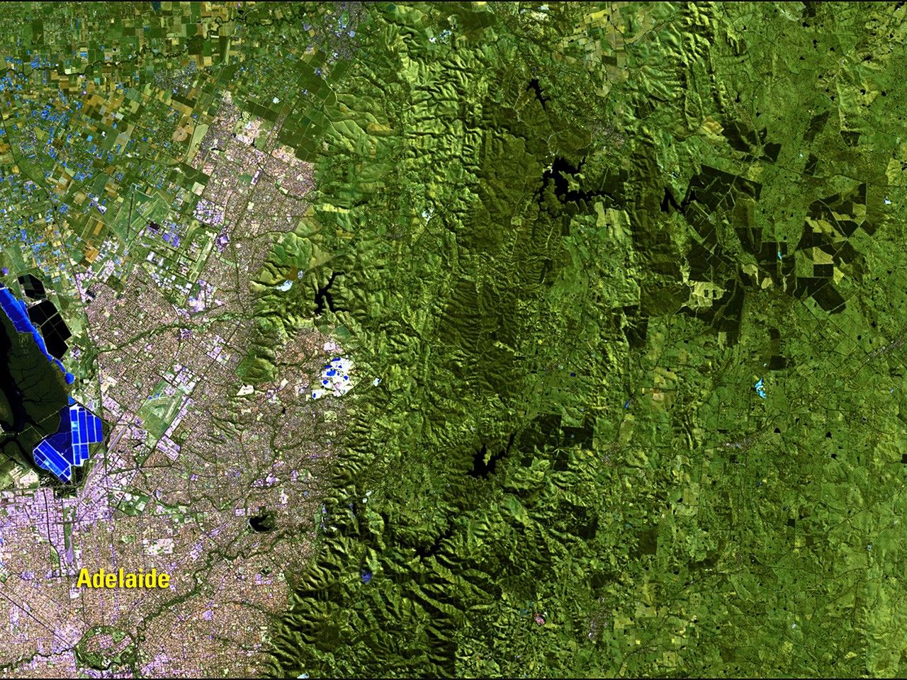
before
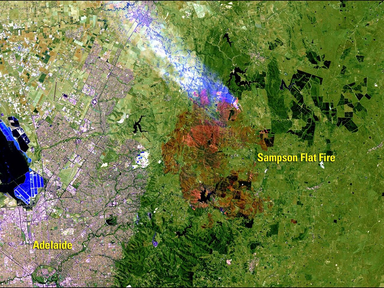
after
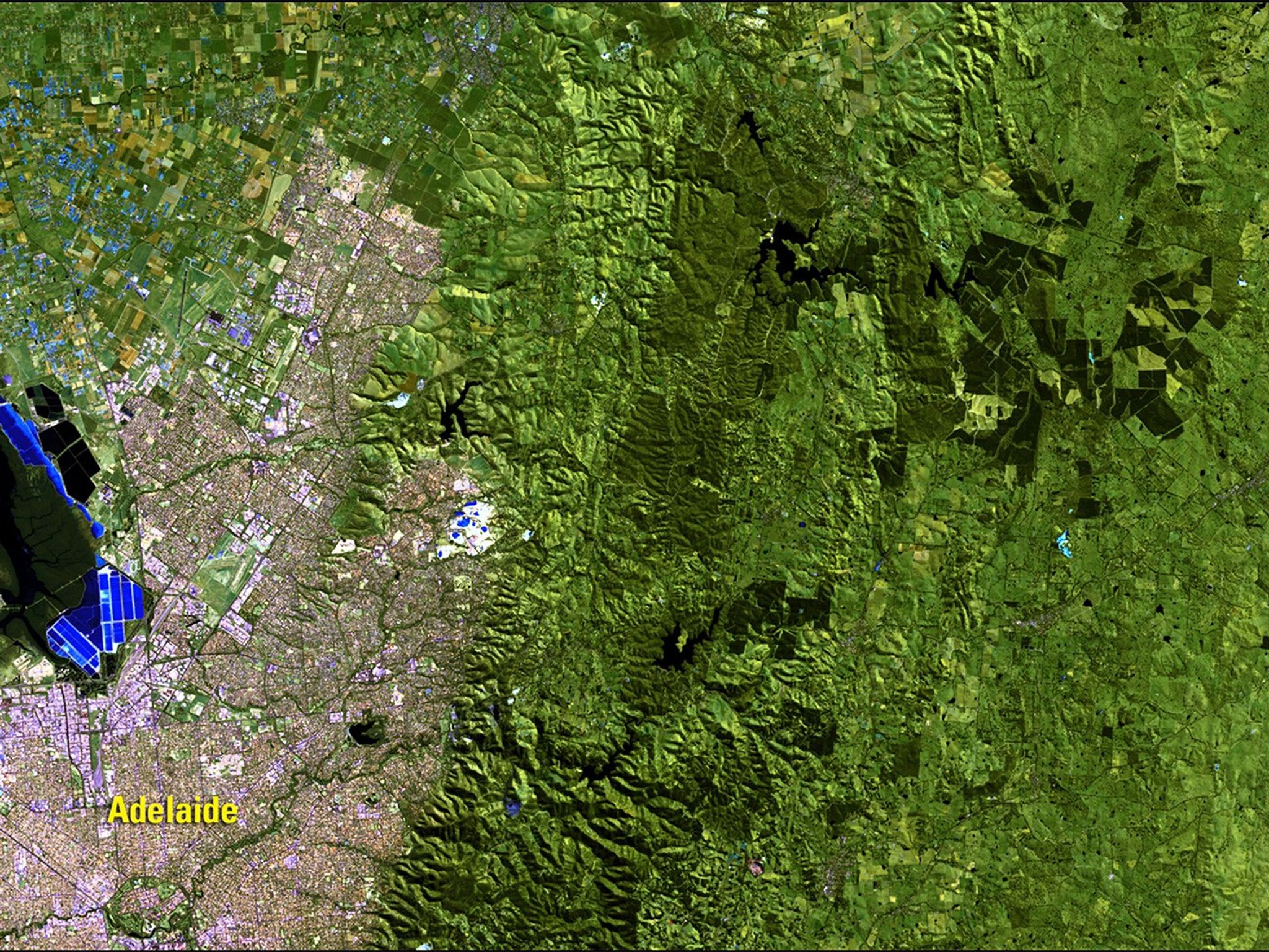
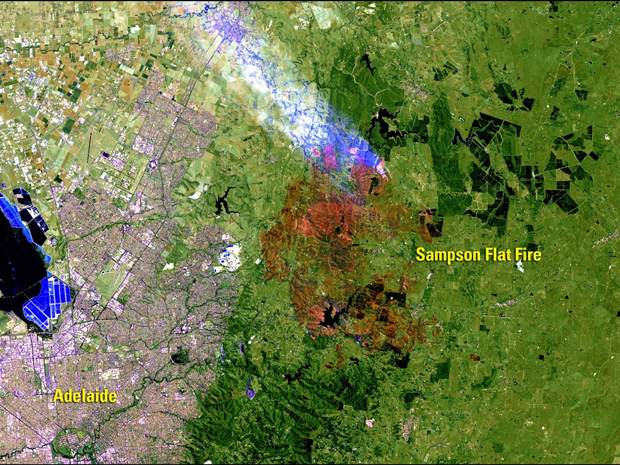
Before and After
Sampson Flat Fire, Australia
August 29, 2014 - January 4, 2015
The Sampson Flat Fire started on January 2, 2015—summer in the Southern Hemisphere—near Adelaide, Australia. Hot, windy weather quickly and erratically spread the fire. By January 7, it had burned more than 46 square miles (120 square kilometers) of woodland and grassland within the Mount Lofty Ranges. In the January image, burned areas are brown and active fire appears red with white-blue smoke rising from it. As of January 9, the fire was contained, but firefighters continued to monitor unburned pockets of vegetation for flare-ups. Images taken by the Operational Land Imager onboard Landsat 8. Source: U.S. Geological Survey (USGS) Landsat Missions Gallery "Sampson Flat Fire, Australia," U.S. Department of the Interior / USGS and NASA.


