


before
after
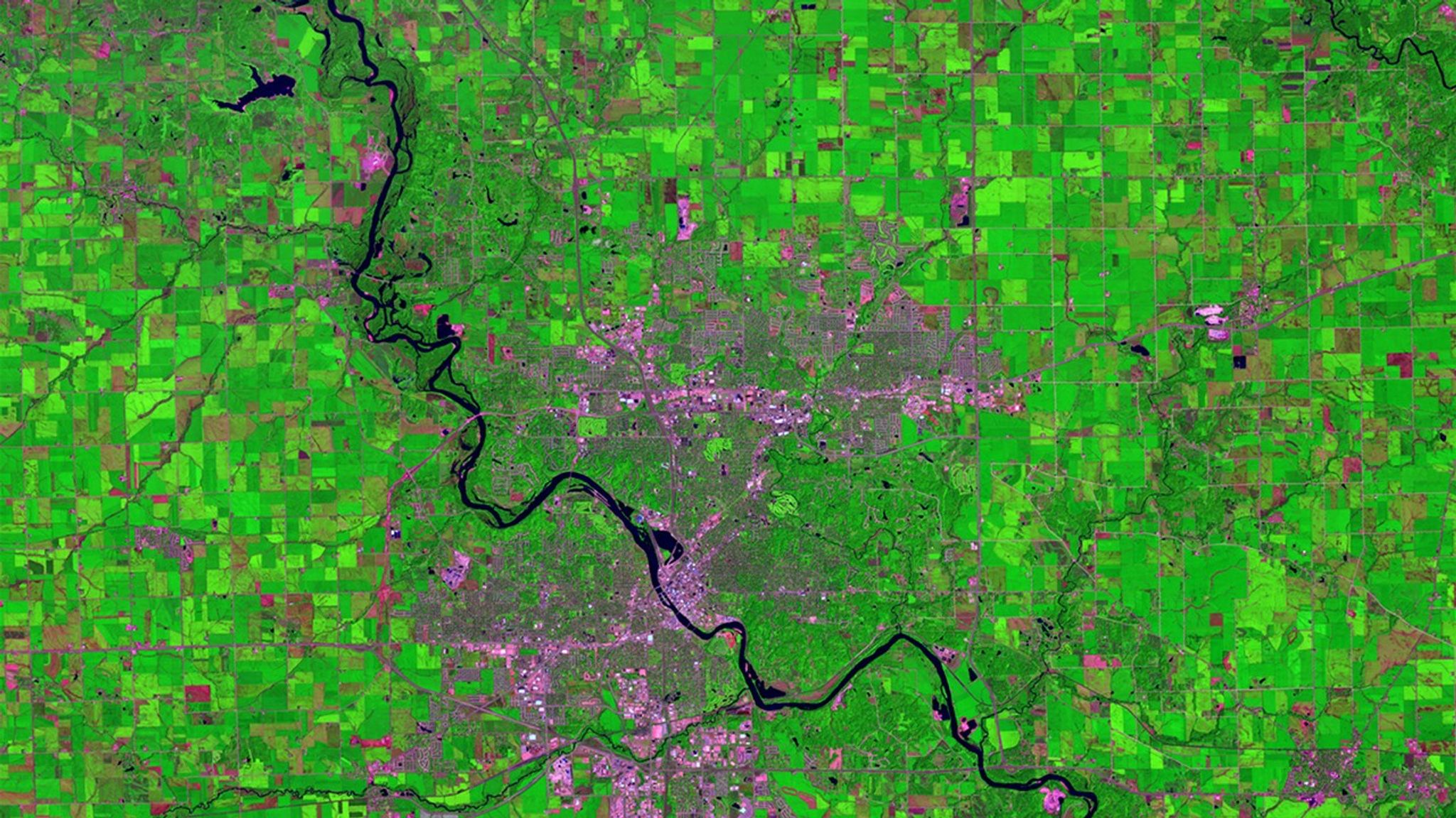
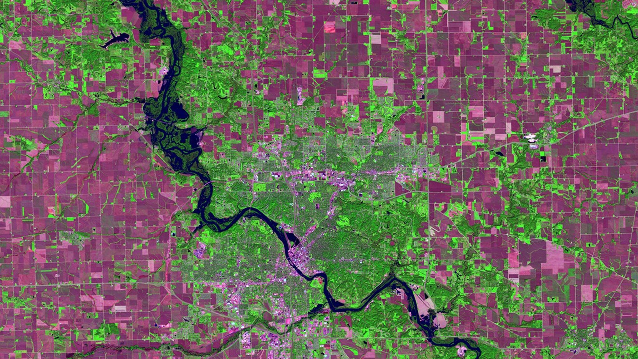
Before and After
Storms swell Cedar River, Iowa
July 8, 2016 - September 26, 2016
Storms that dropped some 10 inches of rain swelled the Cedar River to 6 feet above its major flood-stage designation at Cedar Rapids, Iowa, on September 27, 2016. Authorities advised some 10,000 residents to evacuate. In these images, the countryside appears green during the growing season (July) and magenta when the crops were ready for harvest (September). Images taken by the Operational Land Imager onboard Landsat 8. Source: U.S. Geological Survey (USGS) Landsat Missions Gallery; U.S. Department of the Interior / USGS and NASA.


