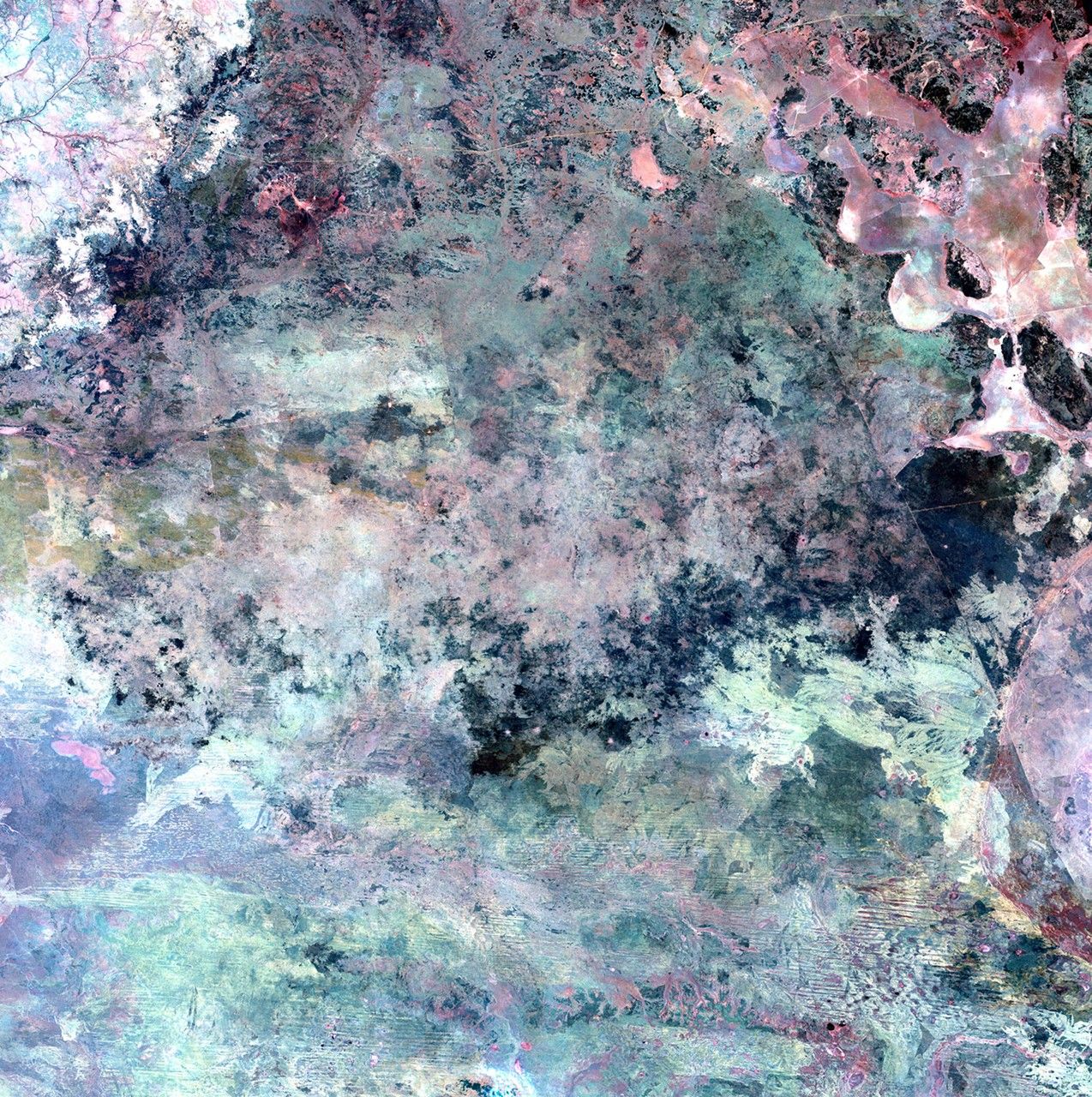
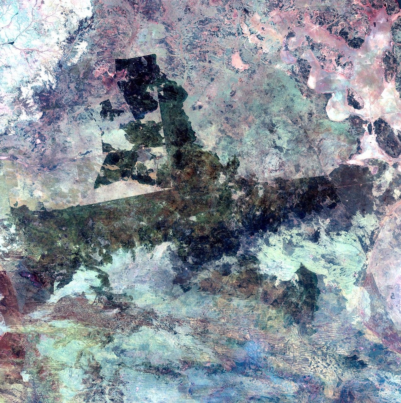
Due to the lapse in federal government funding, NASA is not updating this website.

Suggested Searches

1 min read

Tanami Desert fires, Australia

before
after
Extremely dry conditions have led to major fires in north-central Australia during the past year. In February, fires along the coast caused extensive damage and loss of life. More recently, dry conditions fed many fires in Australia's least populated area, the Tanami Desert region, which is about the size of Texas and Iowa combined. Vegetation on its sand ridges and plains is limited largely to short grasses and shrubs. The September 7 satellite image shows scars (dark area) from previous fires. The September 23 image shows further scarring from active fires.   Images taken by the Thematic Mapper sensor aboard Landsat 5. Source: USGS Landsat Missions Gallery, "Fires Scorch Northern Australia," U.S. Department of the Interior / U.S. Geological Survey.

Before and After

Tanami Desert fires, Australia

June 16, 1991 - June 4, 2010

Extremely dry conditions have led to major fires in north-central Australia during the past year. In February, fires along the coast caused extensive damage and loss of life. More recently, dry conditions fed many fires in Australia's least populated area, the Tanami Desert region, which is about the size of Texas and Iowa combined. Vegetation on its sand ridges and plains is limited largely to short grasses and shrubs. The September 7 satellite image shows scars (dark area) from previous fires. The September 23 image shows further scarring from active fires. Images taken by the Thematic Mapper sensor aboard Landsat 5. Source: USGS Landsat Missions Gallery, "Fires Scorch Northern Australia," U.S. Department of the Interior / U.S. Geological Survey.

Downloads

Image 1

JPEG

(3 MB)

Image 2

JPEG

(3 MB)