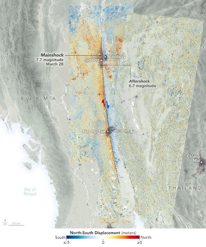
Satellite Data Show Motion of Burma Earthquakes
NASA scientists employed a pixel-tracking method to reveal how much the ground shifted during one of the largest documented surface ruptures of its type.
- X
https://science.nasa.gov/image-detail/amf-254439dc-85da-4f15-b130-e2f0b83d35aa/
Size720x865px