Suggested Searches

This map of the Gulf of Mexico and surrounding land show the hurricane patch tracks Idalia and storm intensity between Aug 26 between the Yucatan peninsula and Cuba,  to Aug 31 off the coast of North Carolina. The path takes it across Florida, Georgia, and South Carolina in a steady arc once landfall is made. The storm intensity that is only became a category 3 and 4 hurricane when crossing a Low-salinity river plume that follows the United States coastline. This is shown with a salinity gradient overlay which shows 33 and below psu blue and 37 and above as vibrant yellow. The region of intensification is over the blue.

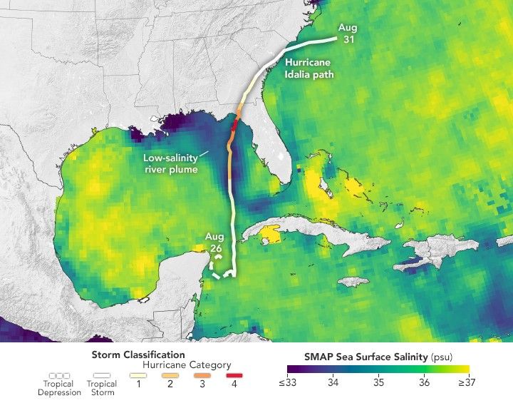
What Was Behind Idalia’s Rapid Intensification?

A new analysis suggests that a large freshwater plume in the hurricane’s path helped fuel its extraordinary growth.

Download