


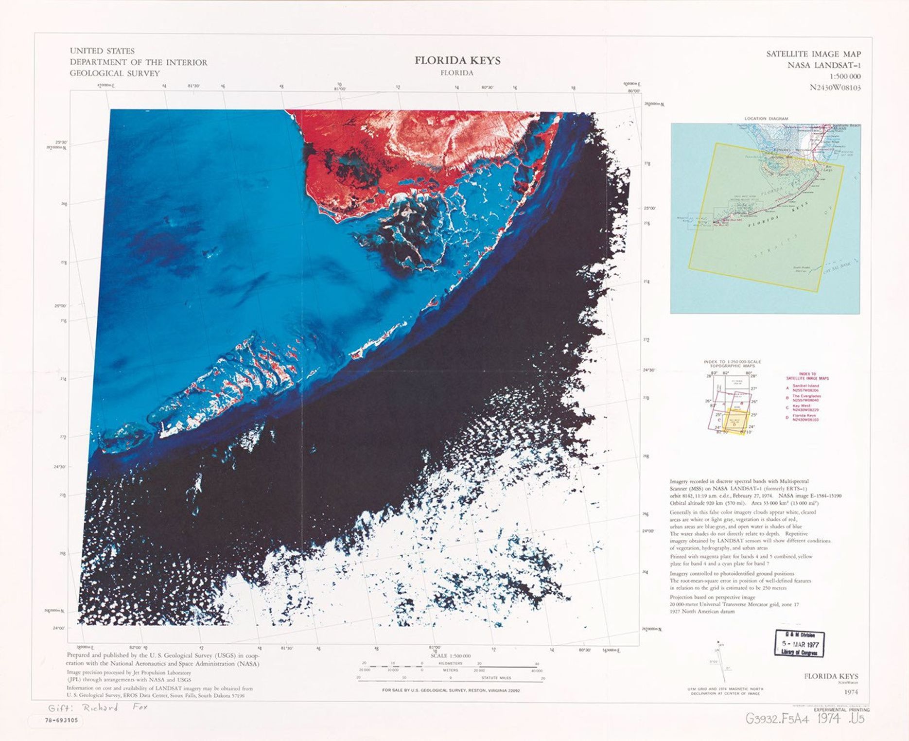
Florida Keys, Florida, satellite image map, NASA LANDSAT-1
This satellite image map was produced by the U.S. Geological Survey in cooperation with NASA using LANDSAT-1 data from 1974. Published in 1977 at a scale of 1:500,000, this experimental printing uses false-color processing to highlight the distinctive curved archipelago of the Florida Keys. The visualization reveals shallow waters in lighter blue tones and deeper ocean waters in darker blue and black, while land areas appear in red and white, showcasing the unique coastal geography of southernmost Florida.
Image Credit: NASA
- X
https://science.nasa.gov/image-detail/amf-49904808-ae24-459b-b105-5035309682a4/
Image CreditNASA
Size1870x1524px
