


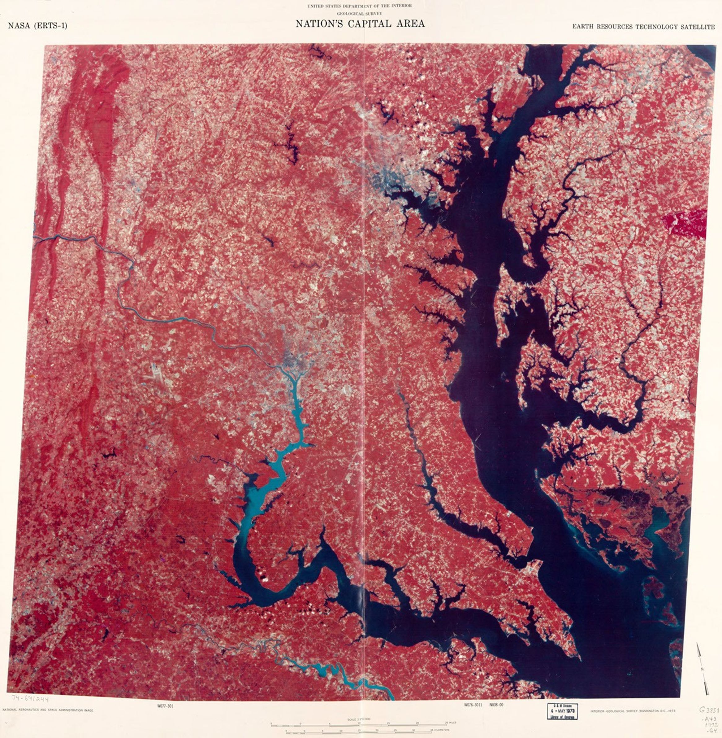
Nation's capital area. [Washington D.C. and Cheaspeake Bay regions]
This false-color composite satellite map was produced in 1973 by the U.S. Geological Survey using multispectral imagery captured by NASA's Earth Resources Technology Satellite (ERTS-1, later renamed Landsat 1) on October 11, 1972. The visualization highlights the Chesapeake Bay and Washington D.C. regions at 1:250,000 scale, with vegetation appearing in red tones and water bodies in dark blue, revealing the distinctive geography of America's capital region and the surrounding watershed.
Image Credit: NASA/Library of Congress
- X
https://science.nasa.gov/image-detail/amf-70fa9222-8c3b-43a6-8117-7c2ad6fc90e0/
Image CreditNASA/Library of Congress
Size2333x2383px
