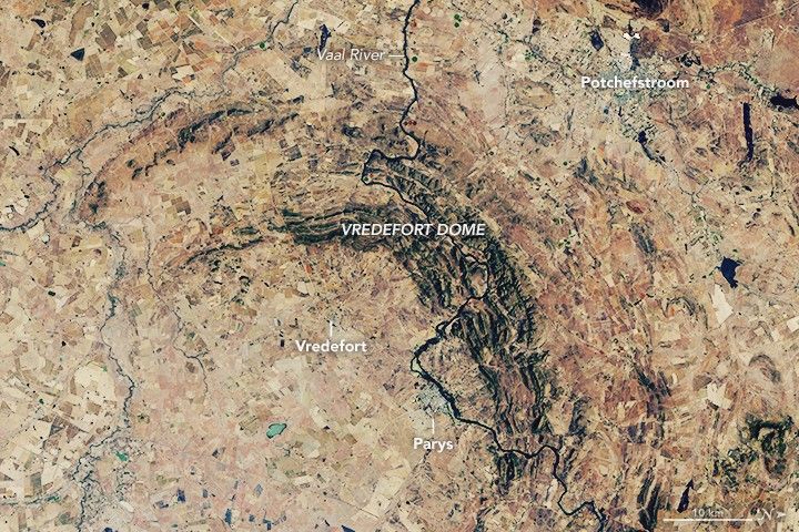
Due to the lapse in federal government funding, NASA is not updating this website.

Suggested Searches

the beige colored landscape is interrupted by an arc of elevated craggy land that is darker in color labeled the Vredefort dome. The Vaal River runs vertically through the this feature as a dark crack on the landscape. Vredefort and the town of Parys are in the lower left from the dome, the latter along the river. Another town is visible in the top right labeled potchefstroom

Blast From the Past: Vredefort Crater

The world’s oldest and largest known impact structure shows some of the most extreme deformation conditions known on Earth.

Download