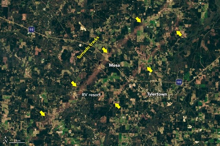
Tornadoes Rip Through MississippiTracks of damage extended dozens of miles after 18 tornadoes plowed through several parts of the state. Facebook Pinterest X LinkedIn Email https://science.nasa.gov/image-detail/amf-7da7d77b-cac2-4961-9746-c1f66159ba6d/Copy URL to clipboard> DownloadShareTagsEarth Observatory Image of the DaySize720x480px