Due to the lapse in federal government funding, NASA is not updating this website.

Suggested Searches

Map of the Western United states with state boundaries overlaid in white and a color overlay gradient corresponding to temperature. Dark red equates to 40 degrees C or more and the colors gradually become lighter shades of orange as temperatures lessen. East Washington and the California Valley down to Phoenix  all represent some of the highest temperatures and darked colors.

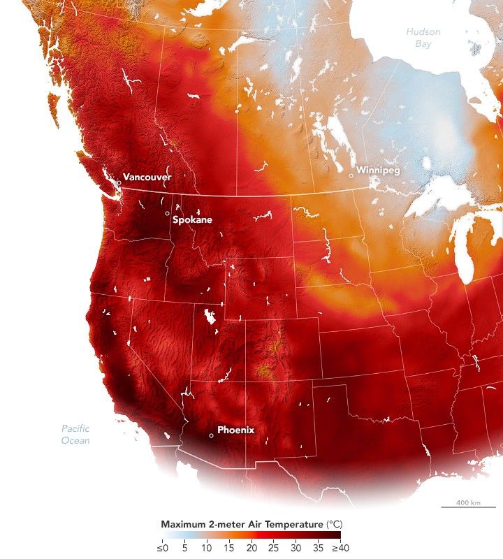
Summer Heat Lingers in the West

A prolonged high-pressure weather system brought unusually warm September temperatures to British Columbia and the Pacific Northwest.

Download