
















CALIPSO
Cloud-Aerosol Lidar and Infrared Pathfinder Satellite
Type
Launch
Target
Objective
The Cloud-Aerosol Lidar and Infrared Pathfinder Satellite Observation (CALIPSO) mission was a pioneering international partnership between NASA and the French Space Agency, CNES. The mission provided valuable, first-of-their-kind vertical profile measurements of clouds and atmospheric aerosols over the globe that are needed to understand their role on climate, weather, and air quality.
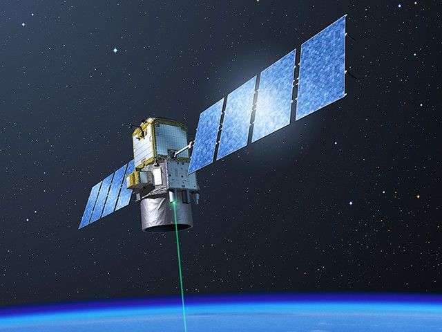
The CALIPSO mission included a sophisticated multi-wavelength backscatter lidar, an imaging infrared radiometer, and a visible imaging camera. CALIPSO was launched together with the CloudSat cloud radar mission in 2006 into orbit with other satellites known as the A-Train constellation. CALIPSO performed beyond expectations and surpassed its 3-year nominal mission with 17 years of on-orbit observations before concluding its science operations in 2023.
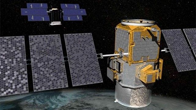
CALIPSO’s long-term record was crucial for helping to answer basic questions about how clouds warm or cool the Earth’s atmosphere, what fraction of clouds contain ice, water, or some combination of both phases, and what are the primary sources of natural and human-made aerosols and how are they regionally and/or globally transported.
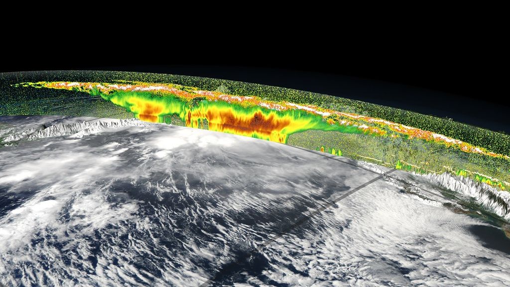
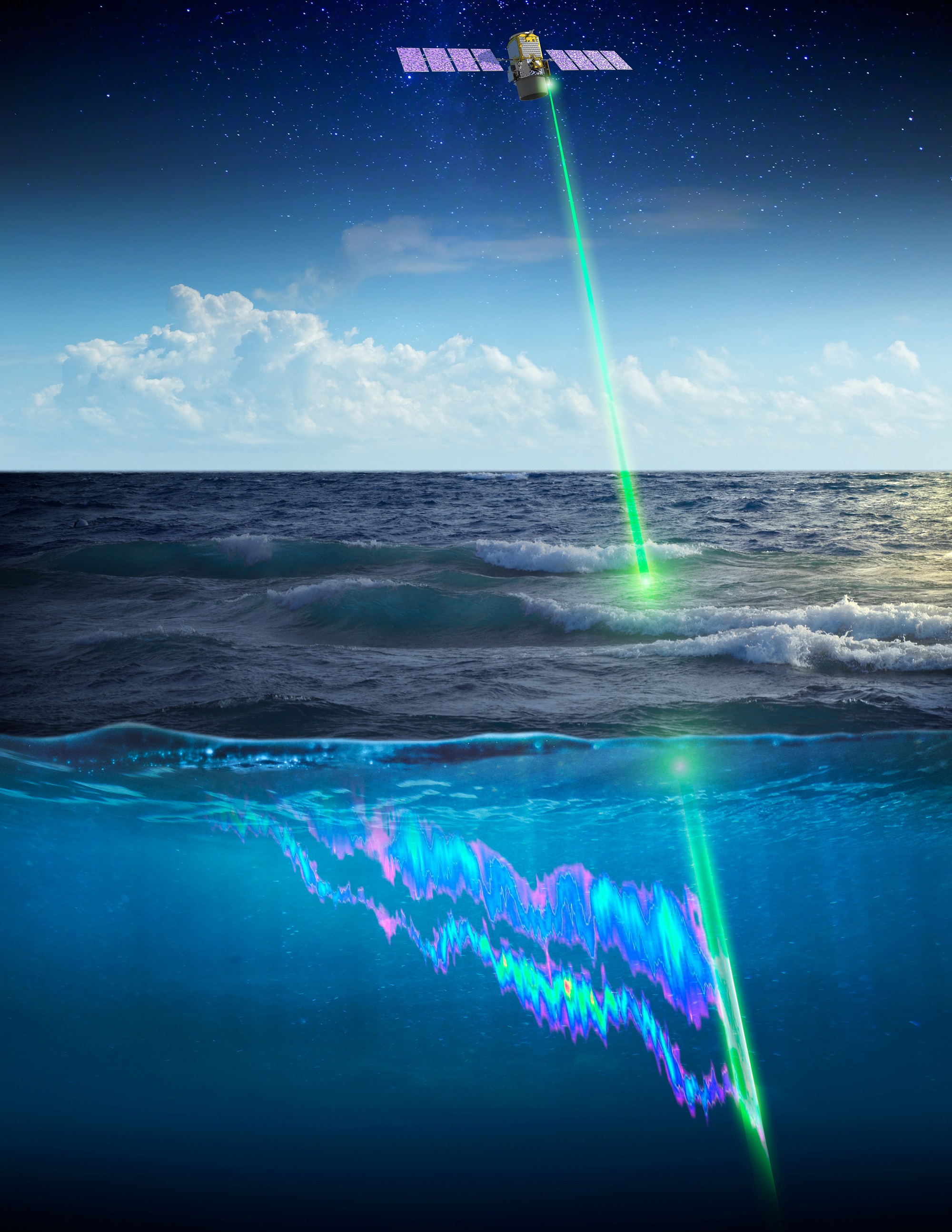
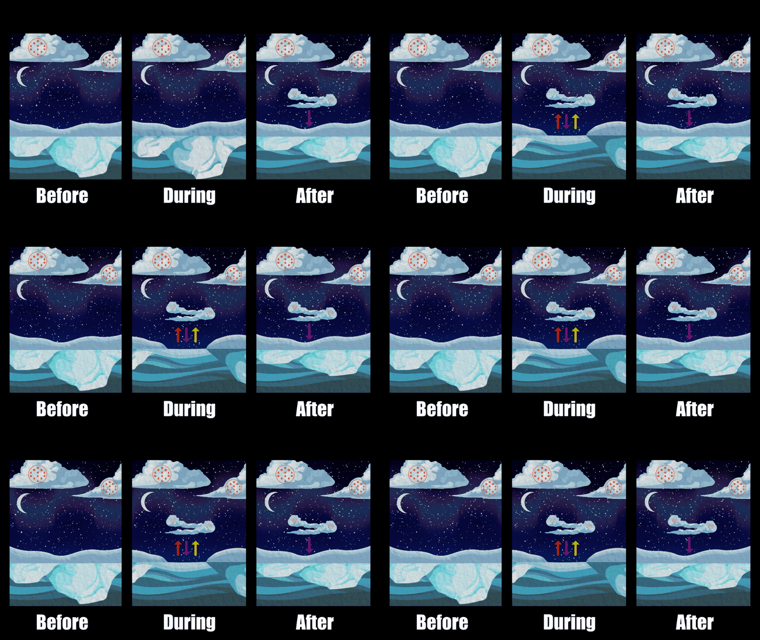
CALIPSO opened many doors of discovery that continue today. CALIPSO’s lidar observations extended and improved upon long-term records on the vertical structure and evolution of volcanic stratospheric aerosols and polar stratospheric clouds — the latter being an essential pathway for the formation of the ozone hole. In addition, new and exciting information on the marine phytoplankton distributions and their seasonal behavior was revealed from the lidar signals that penetrate the ocean surface. New techniques for estimating snow depth from space were also identified using the CALIPSO’s lidar observations.
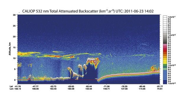
CALIPSO’s highly sensitive profile observations were highly valued by operational weather centers. These observations helped to evaluate the skill of daily forecasts and helped to improve representation of clouds in the forecast models. Moreover, CALIPSO’s observations also provided a unique reference for conventional satellite observations to assess their accuracy and seek improvements. The CALIPSO observations were further recognized as an essential resource by world aviation flight planning centers for detecting the location and altitude of hazardous volcanic plumes.

The mission also demonstrated that lasers could operate in space for long periods and that the measurement technique is stable and resilient. Lessons learned from this pioneering mission will pave the way for future space-borne lidar missions.
.png?w=576&h=808&fit=clip)
The CALIPSO data products are available via NASA’s Earthdata and Atmospheric Sciences Data Center data portals.
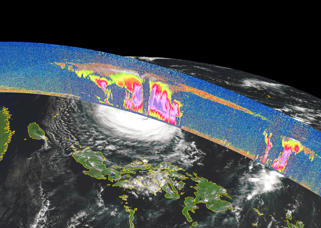
Key CALIPSO Facts
- Joint with France
- OrbitType: Sun-synchronous
- Altitude: 705 km until 2018 (A-Train); 685–705 km after 2018 (C-Train)
- Inclination: 98.2°
- Period: 99 min
- Repeat Cycle: 16 days
- Dimensions: 1.49 m × 1.84 m × 2.31 m
- Mass: 600 kg
- Power: 582 W
- Downlink:
- Prime Mission: 22 monthsDesign Life: 3 years (lasted for 17 years)
The Cloud‑Aerosol Lidar and Infrared Pathfinder Satellite Observation (CALIPSO) mission—an innovative partnership between NASA and the French space agency CNES—fundamentally transformed our understanding of how clouds and aerosols shape Earth’s climate. By uniting spaceborne lidar measurements with advanced infrared imaging, CALIPSO delivered the first long‑term, global view of the vertical structure of multilayer clouds and tiny airborne particles (aerosols), resolving long‑standing uncertainties that had limited weather, climate, and air‑quality prediction.
Launched together with CloudSat on April 28, 2006, CALIPSO flew in tight formation within the A‑Train constellation, enabling uniquely coordinated observations. Though designed for only three years of operation, the mission far exceeded expectations – providing more than 17 years of unprecedented atmospheric profiles. These data were instrumental in quantifying how clouds and aerosols heat or cool the atmosphere, critical processes that influence weather patterns, drive climate change, and affect global air quality. Prior to CALIPSO, these heating and cooling rates were poorly constrained; the mission’s precise measurements dramatically improved them.
CALIPSO also advanced weather and climate modeling by refining how ice and water clouds are represented and by delivering the first global survey of aerosol types. Its observations revealed the pathways through which dust, pollution, and volcanic ash travel across continents, reshaping scientific understanding of regional and global atmospheric transport. Beyond the atmosphere, CALIPSO’s sensitive lidar unexpectedly illuminated patterns in ocean phytoplankton and offered valuable insight into the formation of polar stratospheric clouds – key to understanding the ozone hole.
The mission’s high‑fidelity cloud detection capabilities led to substantial improvements in operational weather‑satellite retrievals, enhancing the accuracy of day‑to‑day forecasts. When CloudSat was forced to exit the A‑Train in 2018 due to technical issues, CALIPSO followed to preserve the historic lidar–radar record the two missions built together. CALIPSO concluded science operations on August 1, 2023, closing one of NASA’s most scientifically productive Earth‑observing missions. Its legacy is a fundamentally improved ability to observe, model, and predict the complex systems that govern Earth’s atmosphere.
Spacecraft and Instruments
CALIPSO launched a Delta-II rocket from Vandenberg. Thales Alenia Space (prime contractor, formerly Alcatel Alenia Space) built the Proteus spacecraft bus (similar to the design used for Jason-1) with CNES providing funding.
The CALIPSO payload consists of three nadir-viewing instruments: the Cloud-Aerosol Lidar with Orthogonal Polarization (CALIOP–pronounced ‘caliope’) and two passive instruments, the
Imaging Infrared Radiometer (IIR) and the Wide-Field Camera (WFC).
- Cloud–Aerosol Lidar with Orthogonal Polarization (CALIOP). Two-wavelength, polarization lidar capable of providing aerosol and cloud profiles and properties.
- Imaging Infrared Radiometer (IIR). Three-channel infrared imager that complements CALIOP and provides additional cloud properties.
- Wide-Field Camera (WFC). Single-channel, nadir-viewing, push-broom, visible imager that, when combined with IIR data, provides meteorological context around the lidar footprint.
The CALIPSO final report provides a summary of the mission from its origin through its completion:
Data Access
CALIPSO data products are available through the LaRC Atmospheric Science Data Center (https://www.earthdata.nasa.gov/centers/asdc-daac).
https://www.earthdata.nasa.gov/data/instruments/caliop
https://www.earthdata.nasa.gov/data/instruments/iir
https://www.earthdata.nasa.gov/data/instruments/wfc
References
- A Useful Pursuit of Shadows: CloudSat and CALIPSO Celebrate Ten Years of Observing Clouds and Aerosols. The Earth Observer, Jul–Aug 2016 28:4, 4–15. This article, written for the tenth anniversary of CALIPSO (and its sister mission, CloudSat), presents a good overview of the two missions, their objectives, data, and science achievements after their first decade in orbit.