


CloudSat Stories

Over the course of nearly two decades, its powerful radar provided never-before-seen details of clouds and helped advance global weather and climate predictions. CloudSat, a NASA mission that peered into hurricanes, tallied global snowfall rates, and achieved other weather and…
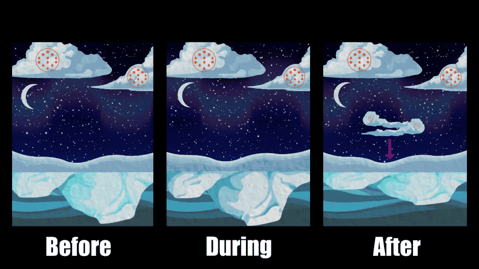
Clouds are one of the biggest wildcards in predictions of how much and how fast the Arctic will continue to warm in the future. Depending on the time of the year and the changing environment in which they form and…
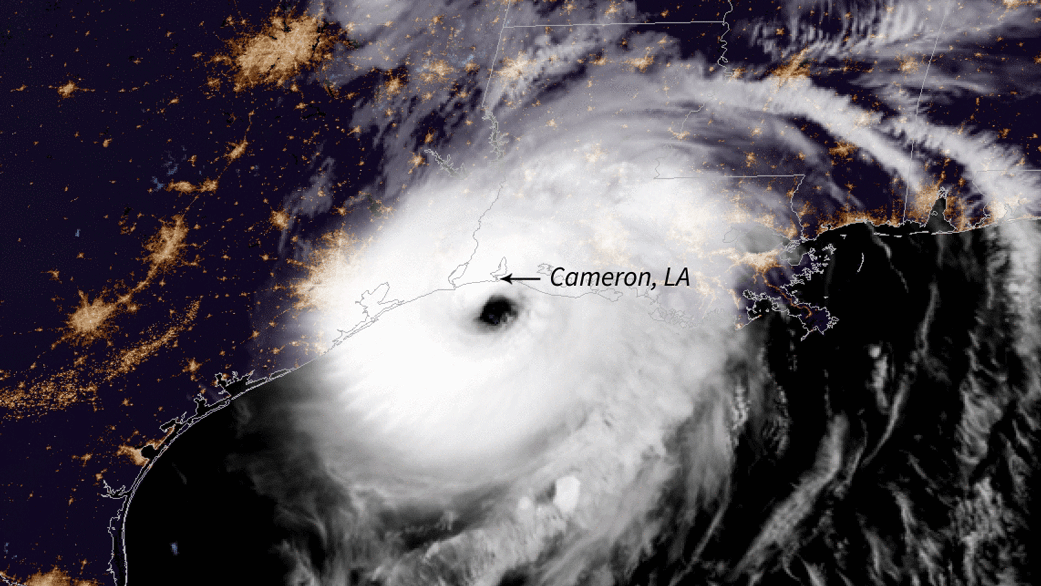
NASA research could help to improve forecasts of whether a hurricane will suddenly intensify, which could give people in its path more time to prepare. In October 2015, Hurricane Patricia in the Northeast Pacific Ocean blew up from a Category…
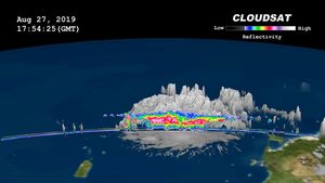
Data from NASA's CloudSat satellite, acquired on Aug., 2019, at 2 p.m. EDT (11 a.m. PDT) was used to make this 3D animation of then-Tropical Storm Dorian. It shows cloud heights extending 9 miles (15 kilometers) into the atmosphere.
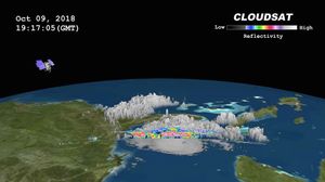
NASA's CloudSat satellite passed over Hurricane Michael on October 9, 2018, at 3:15 p.m. EDT (19:15 UTC) as the storm was intensifying and moving northwest toward the Florida panhandle in the Gulf of Mexico.

NASA's CloudSat satellite flew over Hurricane Maria on Sept. 17, 2017, at 1:23 p.m. EDT (17:23 UTC) as the storm had just strengthened into a hurricane in the Atlantic Ocean.

NASA's CloudSat satellite flew over Hurricane Irma on Sept. 6, 2017 at 1:45 p.m. EDT (17:45 UTC) as the storm was approaching Puerto Rico in the Atlantic Ocean.
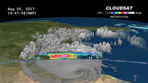
NASA's CloudSat satellite flew over then-Tropical Storm Harvey on Aug. 26, 2017, at 2:45 p.m. CDT (19:45 UTC) as the storm was nearly stationary over south Texas.
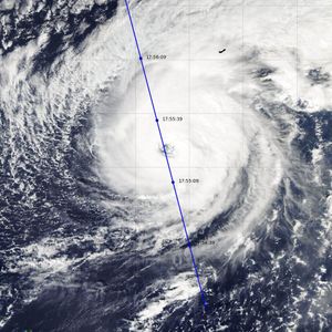
NASA's CloudSat satellite completed an eye overpass of Hurricane Nicole on Oct. 12, 2016, at 10:55 a.m. PDT (17:55 UTC) as the storm was moving toward Bermuda.
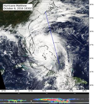
NASA's CloudSat flew east of Hurricane Matthew's center on Oct. 6 at 11:30 a.m. PDT (2:30 p.m. EDT), intersecting parts of Matthew's outer rain bands and revealing Matthew's anvil clouds.
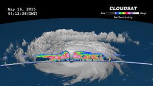
NASA's CloudSat satellite completed a stunning eye overpass of Typhoon Dolphin in the western Pacific Ocean on May 16, 2015, at 0407 UTC.

NASA's CloudSat satellite flew over Typhoon Utor in the West Pacific on Aug. 11, 2013 at 0518 UTC, passing within about 6.2 miles (10 kilometers) from the center of the storm, and revealing the structure of the storm's eye and…