


Lunar Orbiter Laser Altimeter
LOLA Provides a precise global lunar topographic model and geodetic grid that serves as the foundation of essential lunar understanding.
The Lunar Orbiter Laser Altimeter (LOLA) aids future missions by providing topographical data for safe landings and enhance exploration-driven mobility on the Moon. It also contributes to decisions as to where to explore by looking at the evolution of the surface.
LOLA fully achieves three Lunar Reconnaissance Orbiter (LRO) measurement objectives and addresses two other. LOLA will provide all the data necessary to select intriguing, safe landing sites, while providing the reference system needed to navigate to those sites.
LOLA builds on extensive spaceflight heritage, including the Mercury Laser Altimeter (MLA) and the Mars Orbiter Laser Altimeter (MOLA). The LOLA measurement team has 15 years of altimetry experience that includes providing MOLA data to the Mars Exploration Rover site-selection teams.
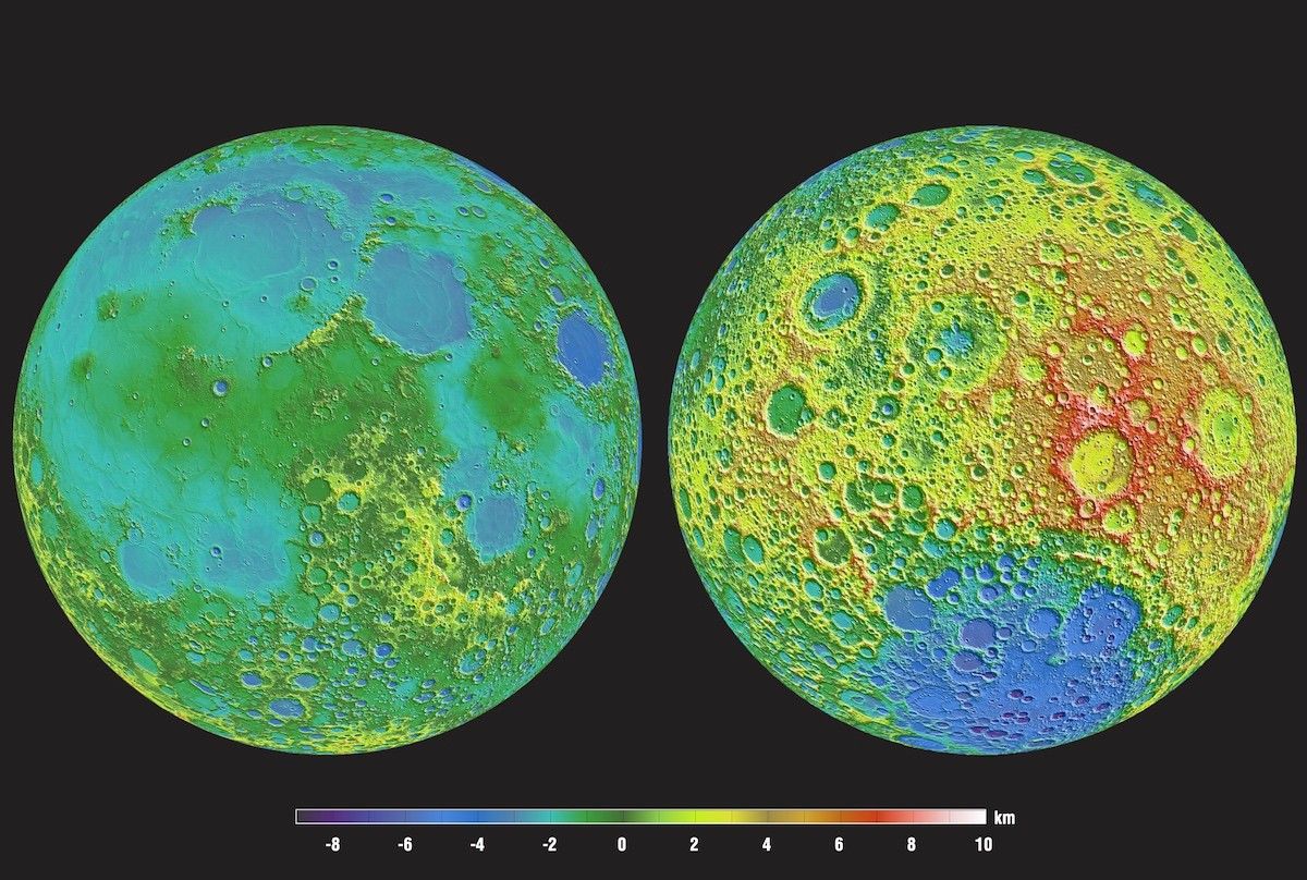
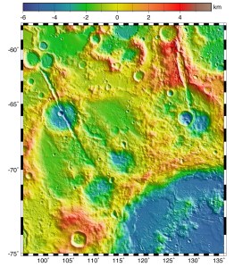
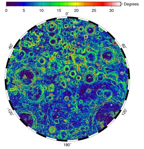
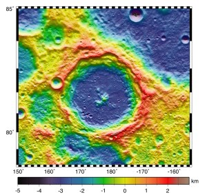
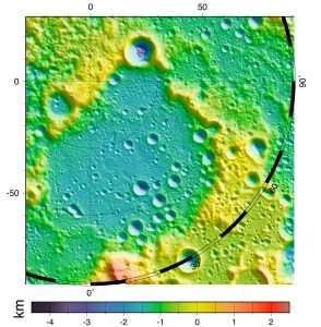
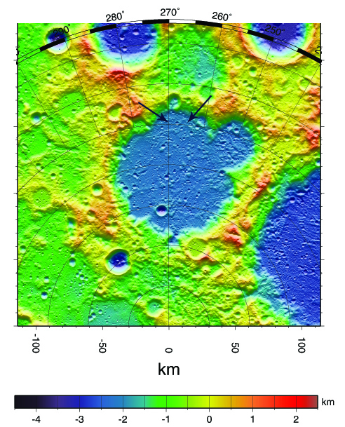
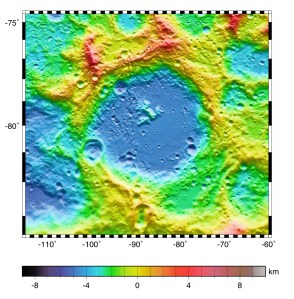
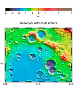
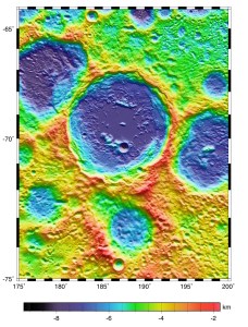
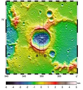
Lunar Orbiter Laser Altimeter (LOLA) Gallery

LOLA Products
LOLA studies the moon in the same way that MOLA studied Mars, but with 3-5 times greater vertical accuracy and 32 times more frequent measurements along track. LOLA produces improved lunar gravity models , as well as global, regional, and local (meter-scale) models of surface brightness, surface slopes, surface roughness and geodetic topography.
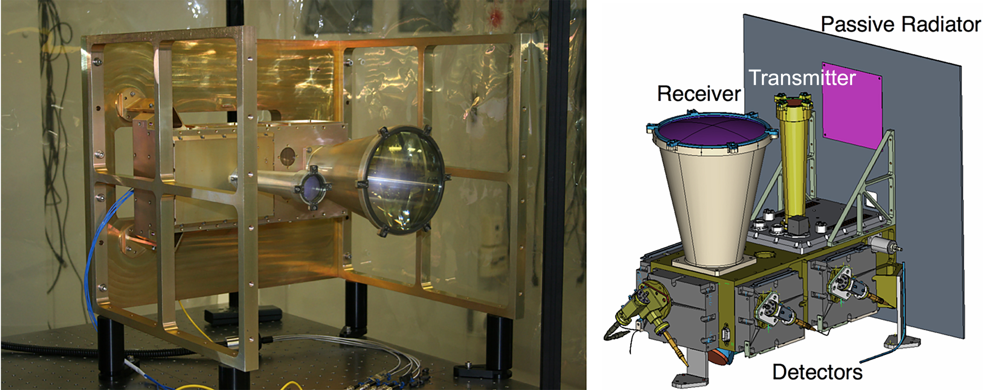
Instrument Operations
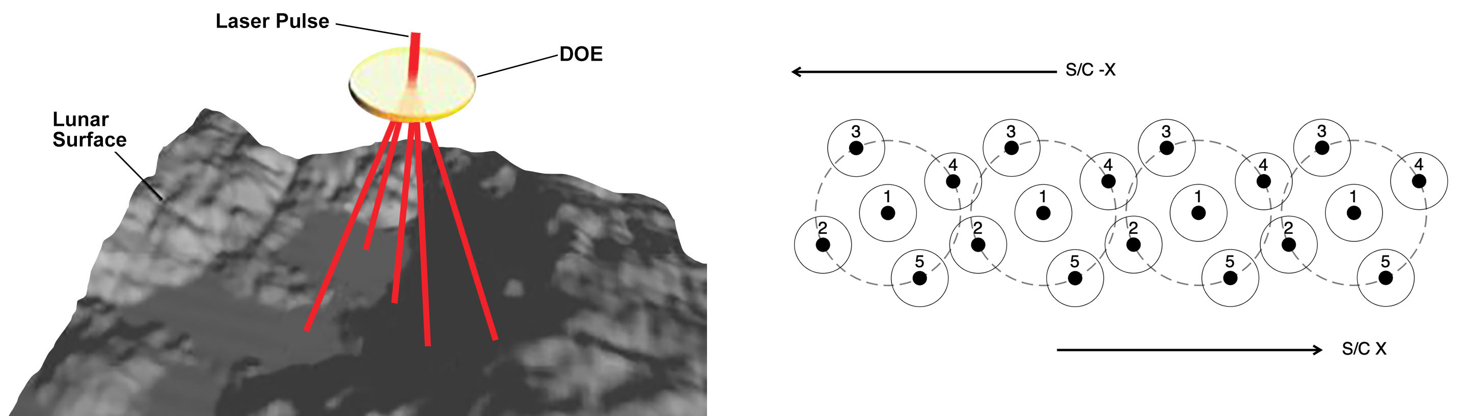
LOLA works by propagating a single laser pulse through a Diffractive Optical Element (DOE) that splits it into five beams. These beams then strike and are backscattered from the lunar surface. For each beam, LOLA measures time of flight (range), pulse spreading (surface roughness), and transmit/return energy (surface reflectance). With its two-dimensional spot pattern, LOLA unambiguously determines slopes along-track and across-track.
In a 50km polar orbit, pulsing the laser at 28 Hz creates an ~50m-wide swatch of five topographic profiles. Swaths will have 1.25km separation at the equator, with [complete polar coverage beyond +/-86 degrees latitude.] Raw measurements are transmitted to Earth for analysis.
LOLA's robust link margin provides ample reserve to accommodate uncertainties in lunar surface roughness and albedo, while providing operational flexibility to the LRO mission.
Educational Resources
Just as the LOLA instrument builds on the heritage of the Mars Orbiter Laser Altimeter (MOLA) and Mercury Laser Altimeter (MLA) instruments, the LOLA education and public outreach (E/PO) plan builds on the success and experience of the MOLA and MLA E/PO plans. The objectives of the LOLA E/PO program are to:
- Inspire the next generation of scientists and engineers through the infusion of lunar data into the classroom (K-12 and undergraduate).
- Reach a broad, diverse audience by distributing materials through various existing networks.
- Produce lunar 3-D topographic models that can be used in a variety of venues with a variety of audiences.
Downloads
- LOLA Fact Sheet [ PDF ]
- The LRO Laser Ranging Investigation [ PDF ]
- The LOLA Investigation on the LRO Mission [ PDF ]
- Optical system design and integration of the LOLA [ PDF ]
- LRO/LOLA Reduced Data Record and Derived Products Software Interface Specification [ PDF ]
- Topography - a LIDAR simulation : Educational activity (Grades 9-12) Describe current efforts and technologies used to study the universe (optical telescopes, radio telescopes, spectroscopes, satellites, space probes, manned missions) [ PDF ]