


TEMPO Stories

Since launching in 2023, NASA’s Tropospheric Emissions: Monitoring of Pollution mission, or TEMPO, has been measuring the quality of the air we breathe from 22,000 miles above the ground. June 19 marked the successful completion of TEMPO’s 20-month-long initial prime…
Ozone high in the stratosphere protects us from the Sun’s ultraviolet light. But ozone near the ground is a pollutant that harms people and plants. The San Joaquin Valley has some of the most polluted air in the country, and…
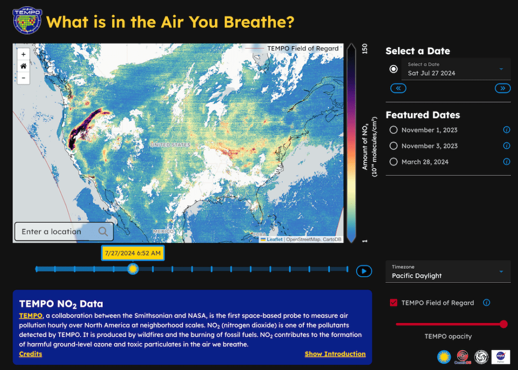
On May 30th, 2024, NASA and the Center for Astrophysics | Harvard & Smithsonian announced the public release of “high-quality, near real-time air quality data” from NASA’s TEMPO (Tropospheric Emissions: Monitoring of Pollution) mission. The NASA Science Activation program’s Cosmic…