








AirMOSS
Airborne Microwave Observatory of Subcanopy and Subsurface
Type
Launch
Target
Objective
The Airborne Microwave Observatory of Subcanopy and Subsurface (AIRMOSS) mission was an aircraft campaign that measured root zone soil moisture (RZSM)—soil moisture at the level of plant roots— to help determine the amount of carbon being exchanged between plants and the atmosphere. This exchange in carbon, also called net ecosystem exchange (NEE), shows how much carbon is put into the environment compared to how much is removed.
The amount o RZSM present impacts photosynthesis, respiration, and transpiration rates. Consequently, knowing the RZSM is important for calculating atmospheric carbon since photosynthesis pulls carbon dioxide (CO2) out of the atmosphere and converts it to sugars in the plant while respiration converts the sugars in the plant back into energy releasing CO2. The amount of soil moisture can change whether an area is uptaking CO2 from the atmosphere or is a net source of CO2 to the atmosphere.
As critical as RZSM measurements are to studies of climate, historically they have not been widespread. Most were localized, point-scale measurements obtained at flux tower sites. These data could be used to define the functional relationships between carbon fluxes and ecosystem parameters (e.g. vegetation cover and soil moisture) – but they could not be used to meaningfully scale-up these relationships to the grid cell of a regional model (50 km), let alone the larger North American continental scale.
NASA selected AirMOSS as one of its first Earth Venture Suborbital missions, changed this. The invesiigation focus sought to:
- Quantify local-, regional-, and continental-sclae heterogeneities of RZSM in North America;
- Quantify how RZSM controls ecosystem carbon fluxes at local, regional, and continental scales; and
- Quanitfy how much estimates of North American NEE improve when accurate information on both the mean and variance of RZSM
AirMOSS flights took place form 2012–2015, with the goal of observing soil moisture over diverse North American climatic regions, understanding the impact of variations in soil moisture on how the atmosphere exchanges carbon with land, and applying the data collected to reduce uncertainty of carbon exchanges to the continental scale of North America. AirMOSS provided the first temporally and spatially sustained direct observations of RZSM data sets for quantifying its control over carbon fluxes in North America.
For most sites, AirMOSS campaigns took place 2–3 times a year over most sites, with flights taking place at least three days over a 10–15 day period. This cadence allowed scientists to measure the changes in RZSM and carbon exchange between different seasons. The same campaigns were repeated each year of the three-year mission. This repetition allowed scientists to measure moisture as it moves through vegetation and evaporated from aerial parts, e.g., leaves, stems and flowers, over a shorter time scale. Observation of RZSM variations at these smaller time scales were applied to the data collected annually in order to reduce significant differences in NEE over the seasons.
Aircraft and Instruments
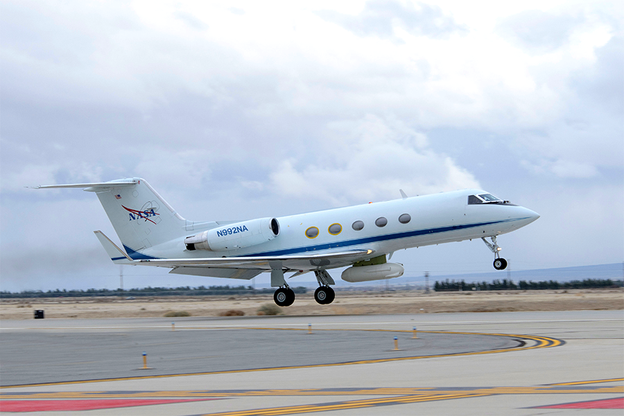
AirMOSS flights took place primarily on a Gulfstream-III (G-III) aircraft to carry the P-band Synthetic Aperture Radar (SAR). This aircraft enabled high-altitude, repeated mapping of North American habitats for soil moisture and carbon data. ABeechcraft Duchess (ALAR) obtained simultaneou in-situ atmospheric measurements
FLUXNET Meteorological Towers: Used to measure fluxes of carbon dioxide, methane, and water vapor.
- P–Band Radar. A fully polarimetric, ultra-high frequency (UHF) SAR that flies on the G-III aircraft and operates in the 280-440 MHz range allowing it to penetrate vegetation canopies and estimate soil moisture up to 1.2 meters deep.
- Airborne Laboratory for Atmospheric Research (ALAR). Consisted of several instruments mounted on Beechcraft Duchess aircraft used for in-situ atmospheric measurements. Instruments included:
- Best Air Turbulence (BAT) Probe: Mounted on the ALAR nose to measure 3D winds and turbulence.
- Picarro Gas Analyzer: A Greenhouse Gas (GHG) spectrometer for measuring atmospheric
- Spectral Radiometer: Often used for surface reflectance measurements.
- In-siu Ground Sensors: Installed to validate the radar data, these include:
- Soil Moisture Probes (Decagon 5-TE/5-TM). Used for measuring volumetric water content, temperature, and electrical conductivity.
- Infrared Thermometers (IRT): To measure surface skin temperature.
- Rain Gauges: To record precipitation.
- FLUXNET Meteorological Towers: Used to measure fluxes of carbon dioxide, methane, and water vapor.
Data Product Access
After the AirMOSS mission was completed, the P-band radar became part of the UAVSAR instrument suite. It is still flown regularly, studying soil moisture, permafrost, landslides, and other applications. P-band radar data are available through UAVSAR's data search.
AirMOSS data products are publicly available through the Oak Ridge National Laboratory Distributed Active Archive Center (ORNL DAAC) for Biogeochemical Dynamics. ORNL DAAC provides an interactive data search .
A full list of AirMOSS data products is also available with with corresponding user guides.
References
- A more complete list of publications is available.