


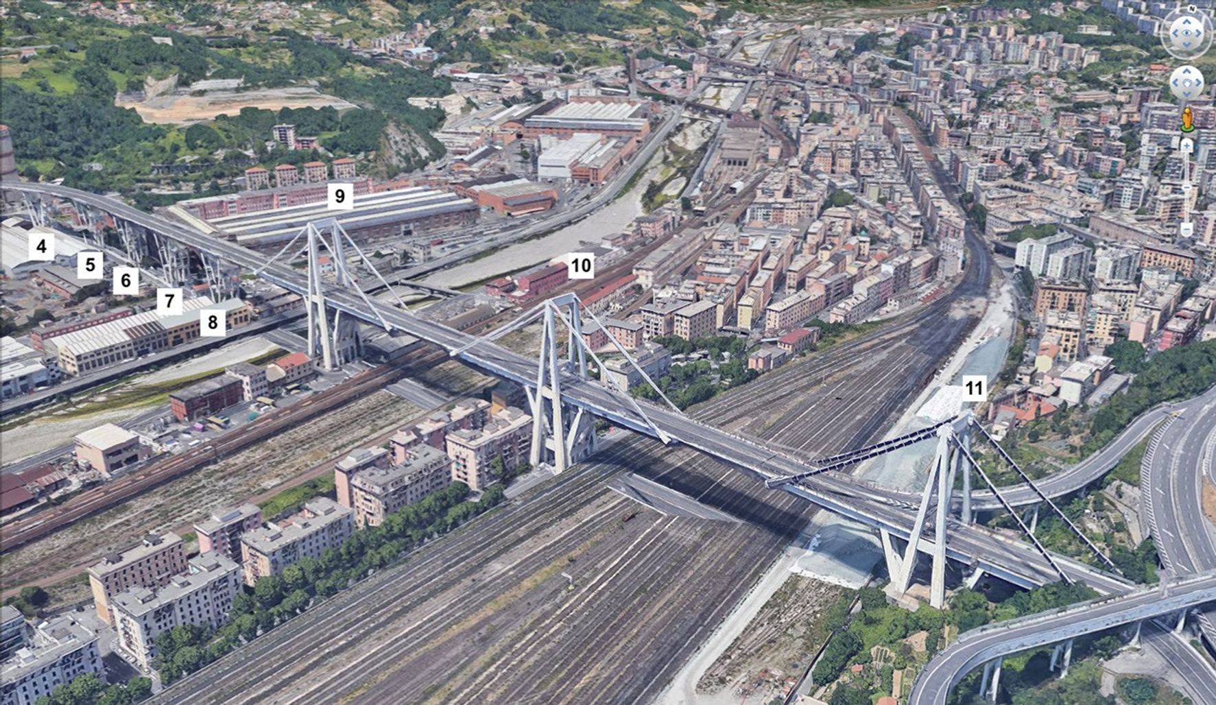
Description
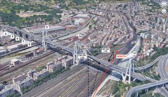
Annotated Image
Click on the image for larger version
A satellite view of the Morandi Bridge in Genoa, Italy, prior to its August 2018 collapse. The numbers identify key bridge components. Numbers 4 through 8 correspond to the bridge's V-shaped piers (from West to East). Numbers 9 through 11 correspond to three independent balance systems on the bridge. In the annotated version, the black arrows identify areas of change based on data from the Cosmo-SkyMed satellite constellation.


