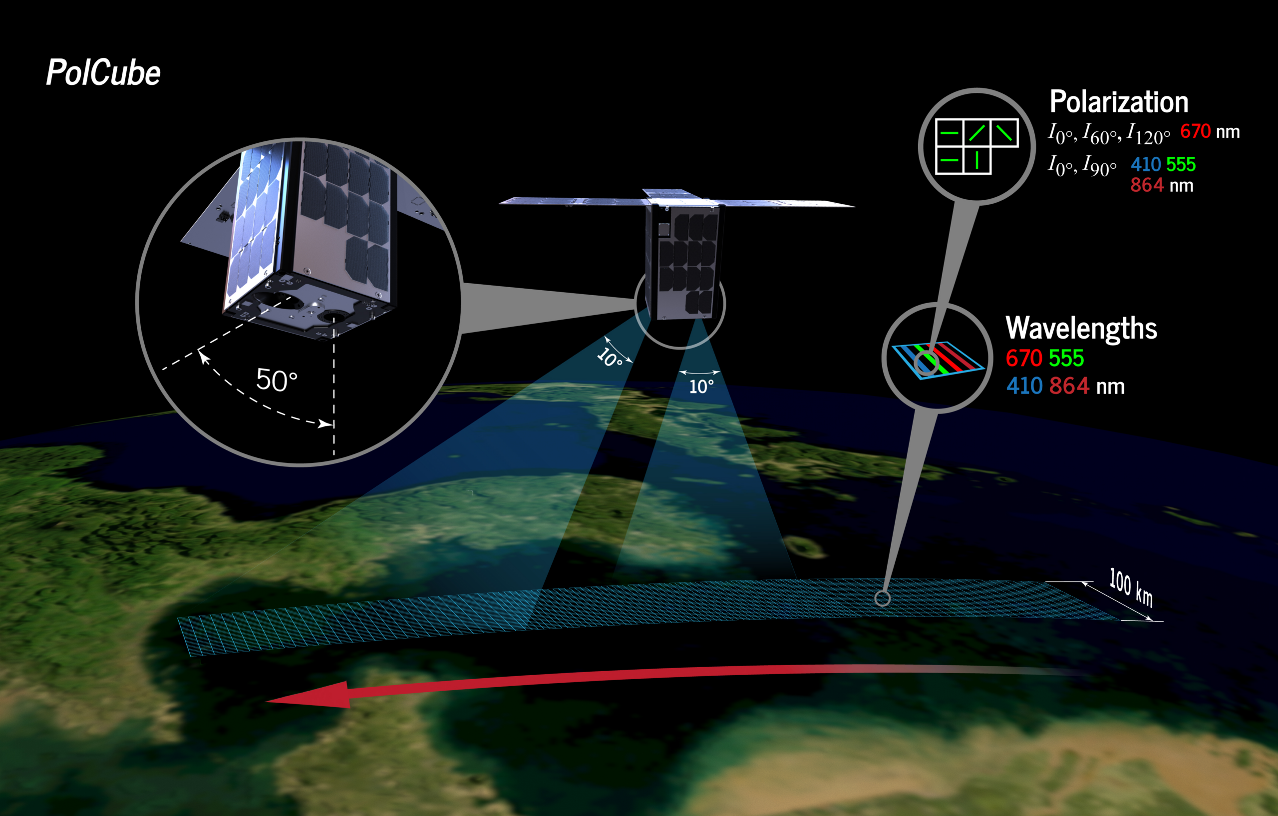
Sentinel-1B
Filters
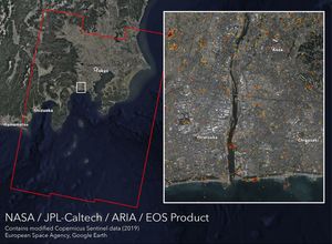
NASA's ARIA team, along with the Earth Observatory of Singapore, created this map showing damage from Typhoon Hagibis, which struck…

NASA's ARIA team used satellite data acquired on Sept. 2, 2019, to map flooding in the Bahamas in the wake…

NASA's ARIA team produced this map of earthquake damage in Southern California from the recent temblors in July, 2019.

This image shows a satellite view of the Morandi Bridge in Genoa, Italy, prior to its August 2018 collapse.

The ARIA team at NASA's Jet Propulsion Laboratory created this updated Damage Proxy Map (DPM) image depicting areas of Northern…

The ARIA team at NASA's Jet Propulsion Laboratory created these Damage Proxy Map (DPM) images depicting areas in Southern and…

The ARIA team at NASA's Jet Propulsion Laboratory created this Flood Proxy Map depicting areas of the Carolinas that are…

The ARIA team at NASA's Jet Propulsion Laboratory created this Damage Proxy Map (DPM) depicting areas of the Carolinas that…

Scientists with NASA's ARIA used satellite data to produce a map of ground deformation on the resort island of Lombok,…