


Ceres Survey Atlas
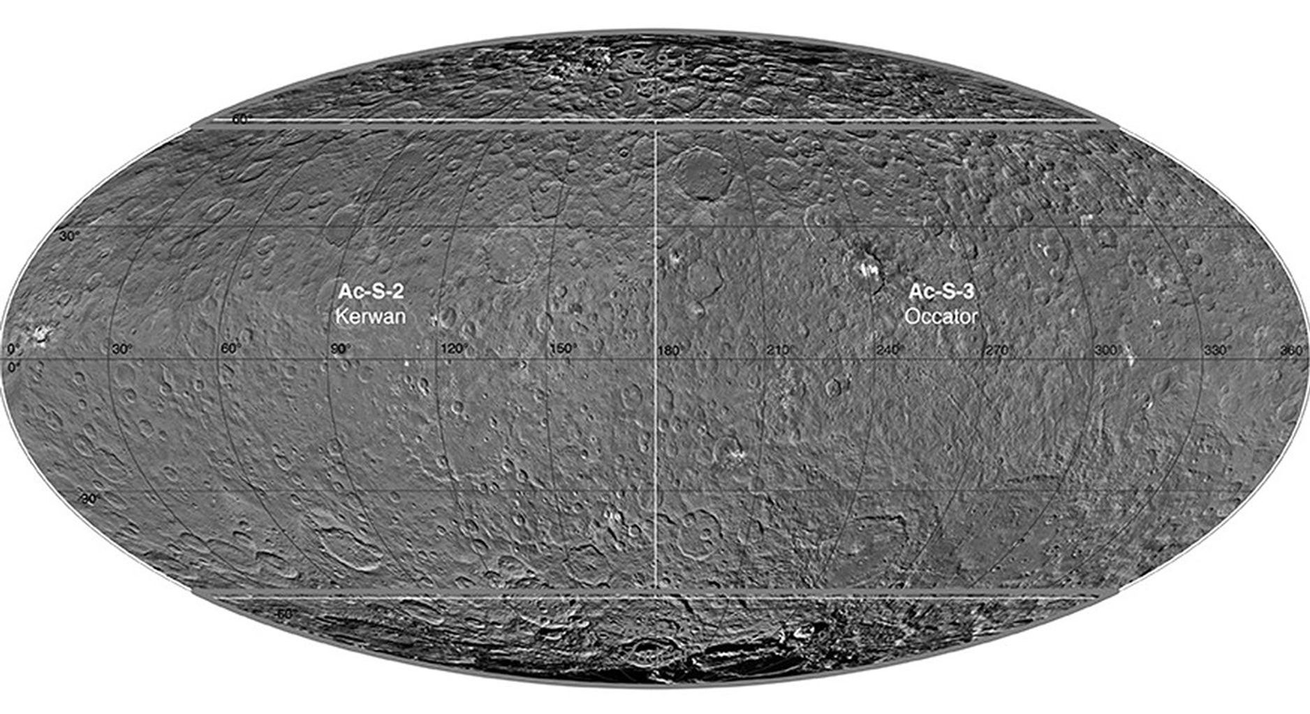
December 1, 2015
| Credit | NASA/JPL-Caltech/UCLA/MPS/DLR/IDA |
|---|---|
| PIA Number | PIA20014 |
| Language |
|
This atlas of Ceres was created using images taken by NASA's Dawn spacecraft in June 2015. Researchers used 12,000 points on Ceres to construct a terrain model, which served as the basis for other maps.