


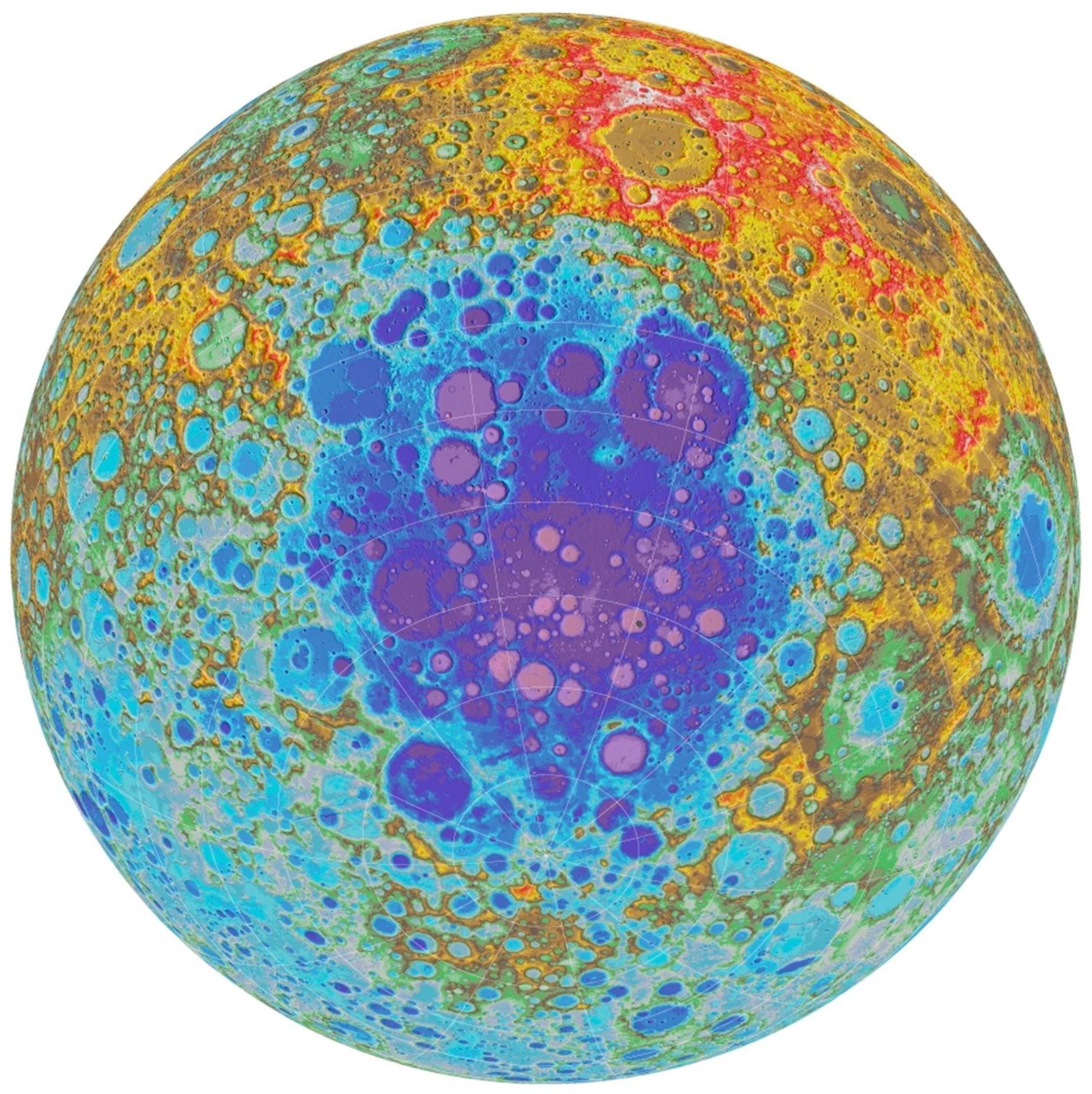
Color Shaded Relief Map of the Moon’s South Polar Region
NASA/GSFC/Arizona State University
November 8, 2017
| Credit | NASA/GSFC/Arizona State University |
|---|---|
| Language |
|
A topographic map of the Moon's south pole and the Aitken basin, the largest observed impact structure on the Moon, based on data from NASA's Lunar Reconnaissance Orbiter. Cooler colors represent lower altitudes. Learn more at: http://lroc.sese.asu.edu/posts/985