Space Shuttle
Filters

An array of satellite sensors observed the long-duration, episodic spread of the state’s historic fire.
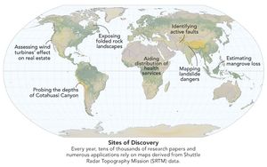
Elevation data collected during a space shuttle mission in 2000 continues to inform science and society in unexpected ways.

It took feats of engineering and deft piloting to map the planet’s topography, an achievement that continues to pay dividends…
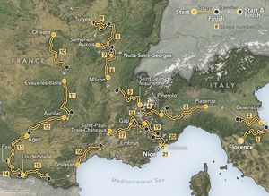
Two of the final stages in the 2024 cycling event traverse high mountain passes in the Western Alps.

This map reveals the depth of floodwater that covered Rio Grande do Sul in May 2024.
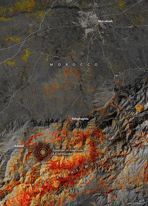
Communities in the High Atlas Mountains were among the hardest hit after a magnitude 6.8 earthquake caused widespread damage.
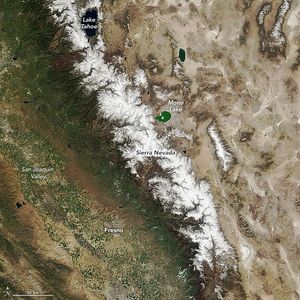
Atmospheric rivers delivered a huge amount of snow to the California mountain range.
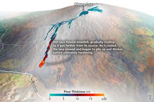
Airborne mapping of the thickness of the lava flows helped scientists calculate that 230 million cubic meters of molten rock…
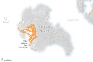
The Landsat program’s 50 years of Earth observations have revolutionized the study of long-term global change, including the losses and…