Visualization and Mapping
Filters

Radar data from the NISAR satellite show that La Guaira and nearby areas experienced significant ground displacement from the June…

Radar data from an agricultural area in South Africa, shown in a vivid color palette, reveal crop types and how…

Wild disturbances are on the rise, while land disturbed by human activity has been decreasing.

Scientists pioneered a new system that combines data from multiple Earth-observing satellites to identify forest clearing up to 100 days…

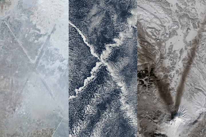
Following a significant winter storm, frigid temperatures lingered in late January 2026 across a vast swath of the U.S.
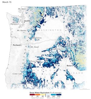
A warm and dry spring in the Pacific Northwest quickly depleted the seasonal snowpack, raising concern over summer water supplies…
We are kicking off 2025 with much to look forward to but also much to look back on.
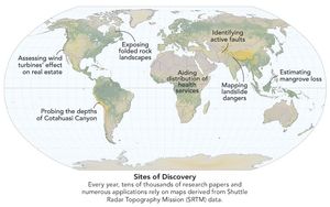
Elevation data collected during a space shuttle mission in 2000 continues to inform science and society in unexpected ways.

It took feats of engineering and deft piloting to map the planet’s topography, an achievement that continues to pay dividends…