


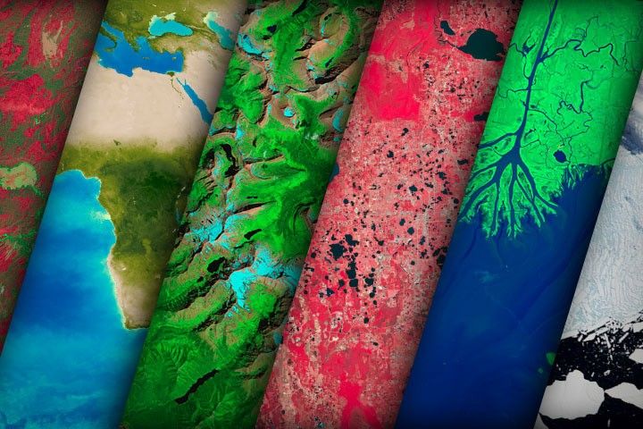
World of Change
NASA satellites document how our world—forests, oceans, human landscapes, even the Sun—changes over months, seasons, and years.

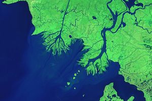
One of the major rivers of Bangladesh has been growing in size, transforming in shape, and changing in location for…
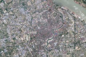
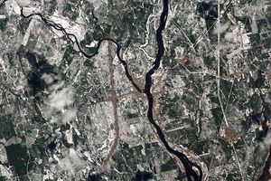
If you could go back in time to the 1980s, you would find a city that is drastically different than…

Shrinking since at least the early 1900s, the ice cover in Glacier National Park is expected to keep declining until…

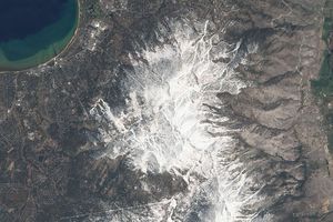
Wet and dry years cause the snow cover to fluctuate.
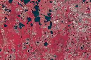
Theme parks and other development has turned Central Florida from swampland to the most visited tourist region of the United…
While the sea overtakes much of the delta plain of the Mississippi River, sediment from the Atchafalaya River is building…

The shoreline of Cape Cod provides a visual case study in the evolution and dynamic motion of barrier islands and…

Prescribed fires should prevent blazes from raging out of control in one of Namibia's most prized wildlife preserves.
Not many places on Earth have year-round greenery and four distinct seasons. The images in this series show the four…

Since 1980, the volume of this glacier that spills into the Prince William Sound has shrunk by half. Climate change…

The Athabasca Oil Sands are at once a source of oil, of economic growth, and of environmental concern. This series…

Fed by glaciers in the Himalayas and Karakorams mountains--and by monsoon rains--the Indus River experiences substantial fluctuations every year. Because…

The average global temperature has increased by a little more than 1 degree Celsius since 1880. Two-thirds of the warming…
Perhaps the most familiar change in our changing world is the annual swing of the seasons. This series of images…

The devastation of the May 1980 eruption of Mt. St. Helens and the gradual recovery of the surrounding landscape is…

In early 2002, scientists monitoring daily satellite images of the Antarctic Peninsula watched in amazement as almost the entire Larsen…

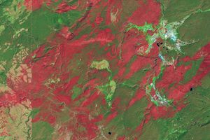
Based on data from the Landsat satellites, these natural-color images document the growth of the Hobet mine in Boone County,…
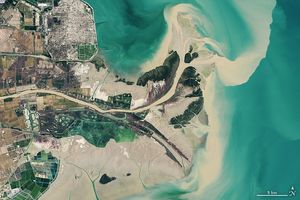
Once free to wander up and down the coast of the North China Plain, the Yellow River Delta has been…

Droughts have taken a severe toll on croplands in Southeast Australia during the past decade.

For many people, El Niño and La Niña mean floods or drought, but the events are actually a warming or…
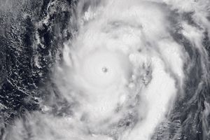
This collection features the strongest hurricane, cyclone, or typhoon (from any ocean) during each of the past 11 years, including…
In 1988, wildfires raced through Yellowstone National Park, consuming hundreds of thousands of acres. This series of Landsat images tracks…

Earth would not be the planet that it is without its biosphere, the sum of its life. This series of…

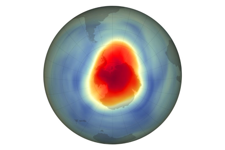
In the early 1980s, scientists began to realize that CFCs were creating a thin spot-a hole-in the ozone layer over…

The state of Rondonia in western Brazil is one of the most deforested parts of the Amazon. This series shows…
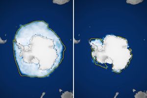
Ice has more room to expand around the continent in winter. But it also stretches into warmer latitudes, leading to…

A massive irrigation project has devastated the Aral Sea over the past 50 years. These images show the decline of…
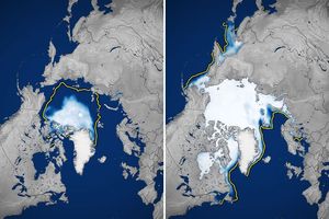
Several record-setting summer lows, combined with poor wintertime recoveries, have fueled a persistent decline over the past few decades.
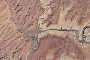
Combined with human demands, a multi-year drought in the Upper Colorado River Basin caused a dramatic drop in Lake Powell.…

In the years following the Second Gulf War, Iraqi residents began reclaiming the country's nearly decimated Mesopotamian marshes. This series…

Images of sunspots and UV brightness document the 11-year cycle of solar magnetic activity. The series spans 1999-2010, capturing the…
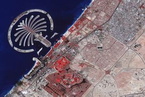
To expand the possibilities for beachfront tourist development, Dubai, part of the United Arab Emirates, undertook a massive engineering project…


