Altimeter
Filters
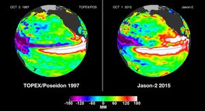
In this side-by-side visualization, Pacific Ocean sea surface height anomalies during the 1997-98 El Niño (left) are compared with 2015…
This image from NASA's European Jason-2 satellite shows Kelvin waves of high sea level (red/yellow) crossing the Pacific Ocean at…

New data from NASA's Jason-2 satellite show near-normal sea surface heights in the equatorial Pacific Ocean persisting for a 16th…

The latest image of sea surface heights in the Pacific Ocean from NASA's Jason-2 satellite shows that the equatorial Pacific…

This figure shows changes in global mean sea level as measured by satellite altimetry (NASA/CNES Topex/Poseidon and Jason-1; and NASA/CNES/NOAA/EUMETSAT…
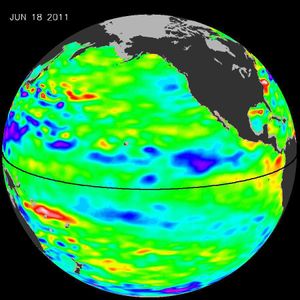
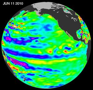
The latest image of Pacific Ocean sea surface heights from the NASA's OSTIM/Jason-2 oceanography satellite, on June 11, 2010, shows…
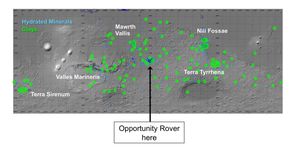
On this map of Mars, spectrometers on spacecraft orbiting Mars have detected clay minerals (green) and hydrated minerals-- clays, sulfates…
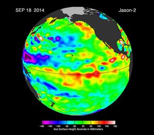
This image from NASA's European Ocean Surface Topography Mission/Jason-2 shows that the moderate El Niño of the past year has…

This map shows northern portion of the Gulf of Mexico's Loop Current, shown in red, appears about to detach a…