SAR
Filters
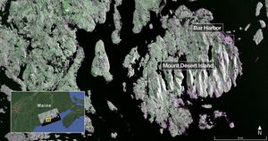
Captured on Aug. 21, 2025, this image from NISAR's L-band radar shows Maine's Mount Desert Island.
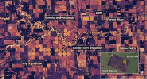
On Aug. 23, 2025, NISAR imaged land adjacent to northeastern North Dakota's Forest River.
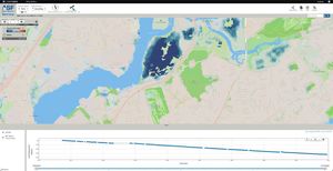
NASA, along with the Jet Propulsion Laboratory, is collaborating with the Alaska Satellite Facility to create a powerful web-based tool…
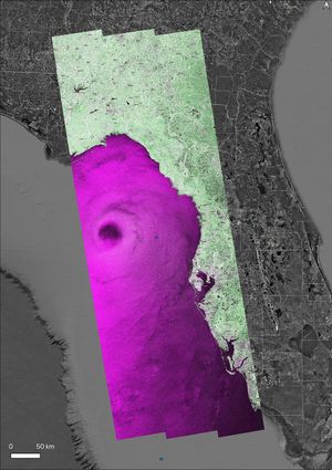
NASA's OPERA project generated a radar image of Hurricane Helene on Friday, Sept. 26, 2024, at 7:38 p.m. local time,…
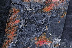
The magnitude 7.8 and 7.5 earthquakes that struck southern Turkey and western Syria on February 6, 2023, caused widespread destruction…
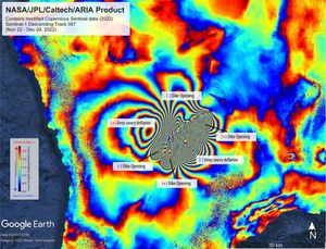
The NASA-supported ARIA project created this false-color map of ground movement resulting from the Mauna Loa volcano eruption in Hawaii.…
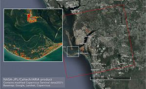
NASA scientists are using satellite data to assess the damage on Florida's Gulf Coast after Hurricane Ian, which made landfall…
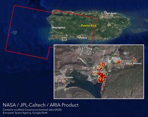
NASA's ARIA team mapped damage in southwestern Puerto Rico following a 6.4-magnitude quake and hundreds of aftershocks. Guanica, west of…
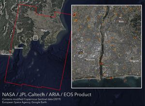
NASA's ARIA team, along with the Earth Observatory of Singapore, created this map showing damage from Typhoon Hagibis, which struck…