Jason-1
Filters
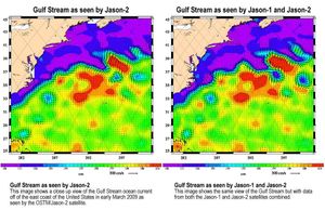
Created with altimeter data from NASA's Ocean Surface Topography Mission (OSTM)/Jason-2 satellite and the Jason-1 satellite, this image shows a…
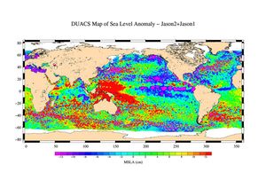
This is the first global map of ocean surface topography produced with data from the interleaved tandem mission of NASA's…
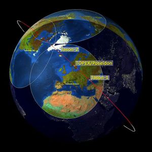
This image is a 'family portrait' of Topex/Poseidon, Jason-1 and Ocean Surface Topography Mission/Jason-2 (OSTM/Jason-2), NASA satellites that have measured…
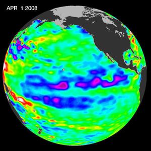
This image of sea-surface height measurements from NASA's U.S./French Jason-1 oceanography satellite shows the Pacific Ocean remains locked in a…
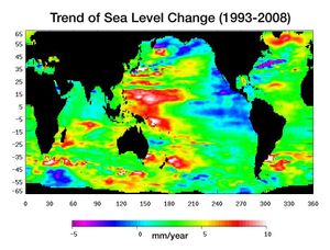
Data from NASA's Jason satellite shows warming water and melting land ice have raised global mean sea level 4.5 centimeters…
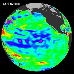
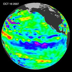
One of the strongest La Niñas in many years is slowly weakening but continues to blanket the Pacific Ocean near…
The tropical Pacific Ocean remains in the grips of a cool La Niña, as shown by data of sea-level heights…
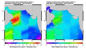
This pair of images from the radar altimeter instrument on NASA's US/France Jason mission revealed information on wind speeds and…
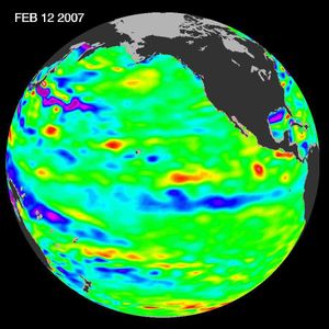
Data of sea-level heights from early February, 2007, by NASA's Jason altimetric satellite show that the tropical Pacific Ocean had…