


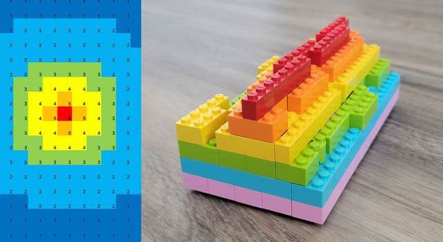
Students analyze simulated radar data to map surface elevations on a grid.
In this activity, students analyze simulated radar data to map surface elevations on a grid. Next, they determine what kind of surface feature is displayed by the data. Students then build a physical model representing their data.
View the full classroom activity on the JPL Education website ›