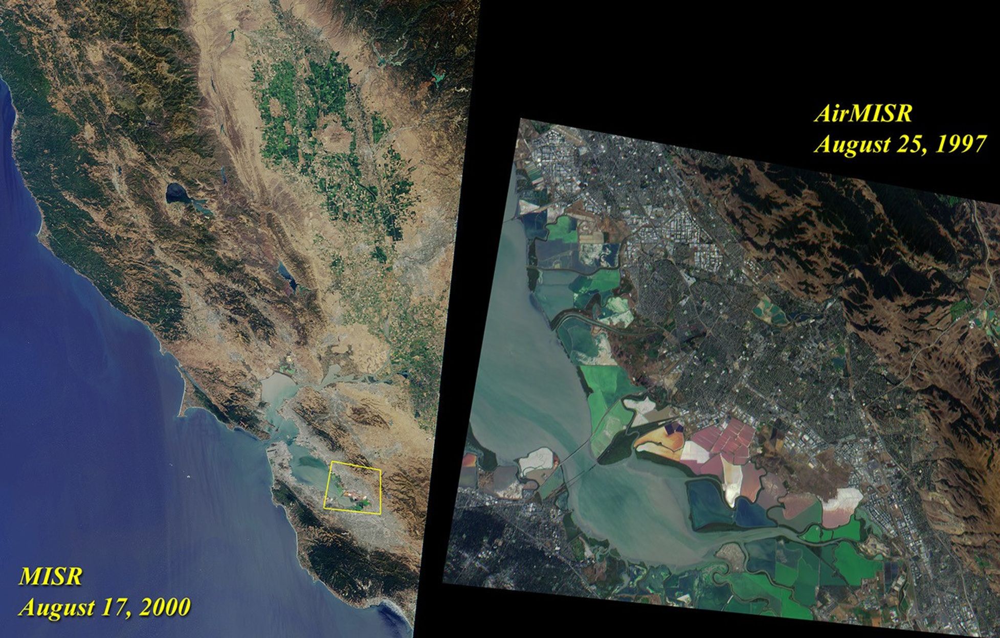
The left image of this pair was acquired by Multi-angle ImagingSpectroradiometer’s (MISR's) nadir camera onAugust 17, 2000. Toward the top, and nestledbetween the Coast Range and the Sierra Nevadas, are the green fields ofthe Sacramento Valley. The city of Sacramento is the grayish area nearthe right-hand side of the image. Further south, San Francisco and othercities of the Bay Area are visible.
On the right is a zoomed-in view of the area outlined by the yellowpolygon. It highlights the southern end of San Francisco Bay, and wasacquired by MISR’s airborne counterpart, AirMISR, during an engineeringcheck-out flight on August 25, 1997. AirMISR flies aboard a NASA ER-2high-altitude aircraft and contains a single camera that rotates todifferent view angles. When this image was acquired, the AirMISR camerawas pointed 70 degrees forward of the vertical. Colorful tidal flats arevisible in both the AirMISR and MISR imagery.
References & Resources
Image Courtesy NASA/GSFC/JPL, MISR and AirMISR Teams