










Suggested Searches

1 min read

Typhoon Koni

Instruments:
Typhoon Koni
July 22, 2003

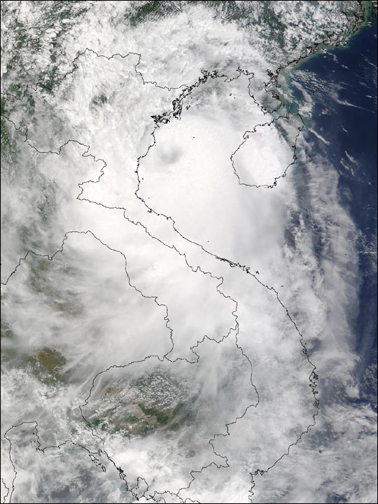
Centered in the Gulf of Tongking, Typhoon Koni sprawls over Vietnam (center), and part of Laos (to the east). The eastern edge of the storm drapes the island of Hainan, south of China. This Moderate Resolution Imaging Spectroradiometer (MODIS) image is from the Terra satellite on July 22, 2003.

References & Resources

Image courtesy Jacques Descloitres, MODIS Rapid Response Team at NASA GSFC
You may also be interested in:

Stay up-to-date with the latest content from NASA as we explore the universe and discover more about our home planet.

New Zealand’s Southern Wilderness
3 min read

Stewart Island/Rakiura, New Zealand’s third-largest island, is known for its vibrant birdlife, unique forests, wilderness beaches, and views of the…

Article
Super Typhoon Bavi
3 min read

The third category 5 tropical cyclone of 2026 crossed the U.S. Northern Mariana Islands and Guam before continuing toward Asia.

Article
Lala Batters Hawaii
3 min read

The powerful storm delivered extreme rainfall and damaging winds to the state, passing the Island of Hawaiʻi as a category…

Article