![Request for Information – Potential [Placeholder for Prize]](https://assets.science.nasa.gov/dynamicimage/assets/science/psd/solar/2023/09/s/solarsystem_0.jpg?w=1024)


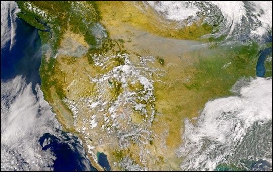
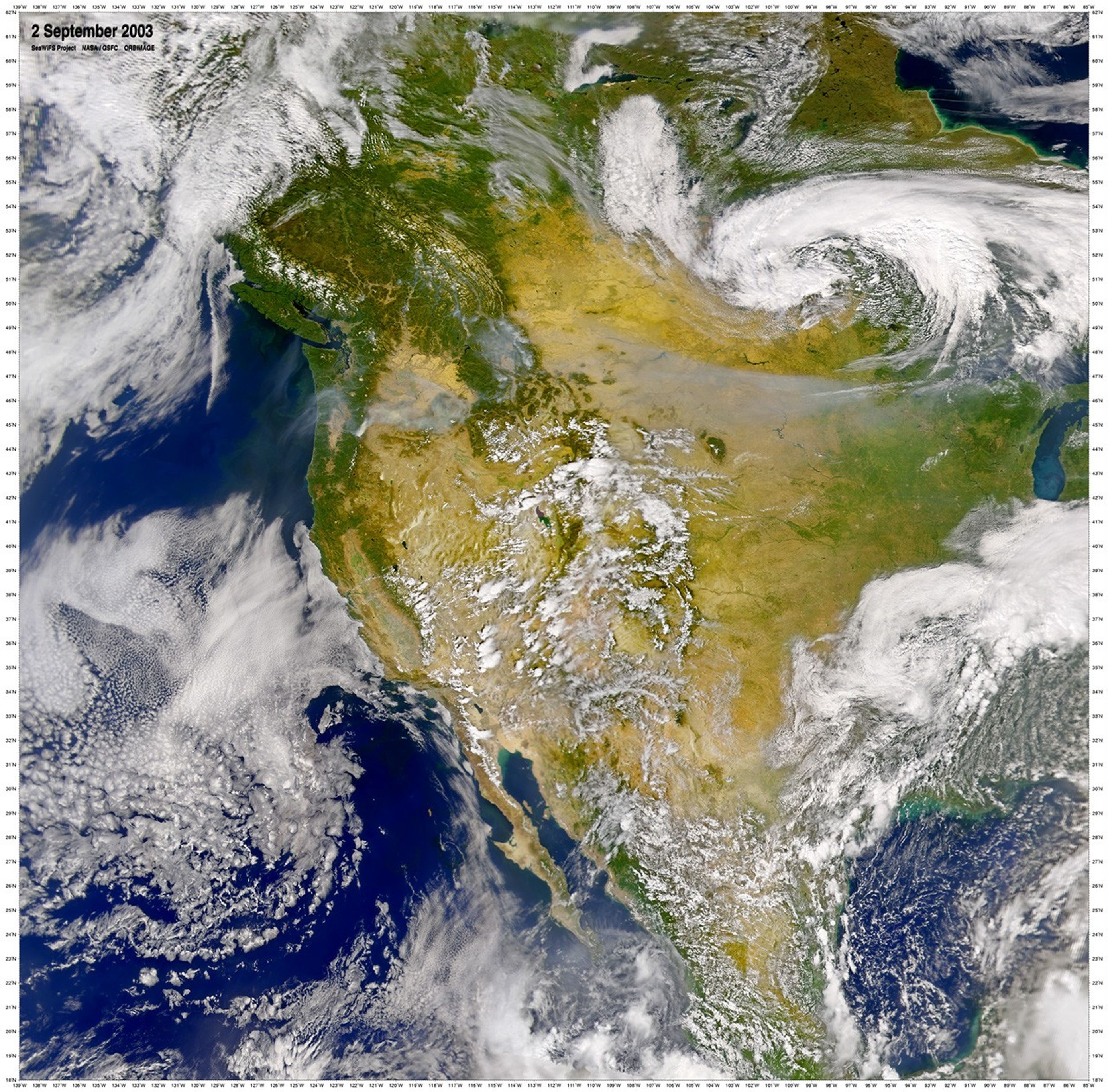
September 2, 2003
Smoke pouring from numerous fires in thenorthwestern United States and Canadaobscured the ground over much of the Pacific Northwest and Great Plains region. The smoke (gray pixels) was so thick it filled a number of the valleys in the mountainous regions of the northwest. Some of the smoke appears to have been drawn eastward along the southern edgeof the low-pressure cell visible overManitoba (in the high-resolution version of this scene).
This true-color image was acquired by the Sea-viewing Wide Field-of-view Sensor (SeaWiFS) on September 2, 2003.
References & Resources
Image courtesy the SeaWiFS Project, NASA/Goddard Space Flight Center, and ORBIMAGE