![Request for Information – Potential [Placeholder for Prize]](https://assets.science.nasa.gov/dynamicimage/assets/science/psd/solar/2023/09/s/solarsystem_0.jpg?w=1024)


Residents of the Seattle-Tacoma, Washington, region were rocked onFebruary 28 (yesterday) by a magnitude 6.8 earthquake that sent outshockwaves felt as far away as Salt Lake City, Utah. Although this isconsidered to be a major magnitude earthquake, and there was widespreadstructural damage reported throughout the Seattle region, the severityof the impact is considered to be somewhat modest. According to theUnited States Geological Survey (USGS), the quake's epicenter was about30 miles (48 km) below the surface. That fact combined with improvedbuilding design codes helped minimize the property damage. Forinstance, the Space Needle—Seattle's renowned landmark—wasdesigned to sway in high winds rather than stand rigid. Dozens oftourists rode out the earthquake atop the 600-foot-tall (182 m) tower.
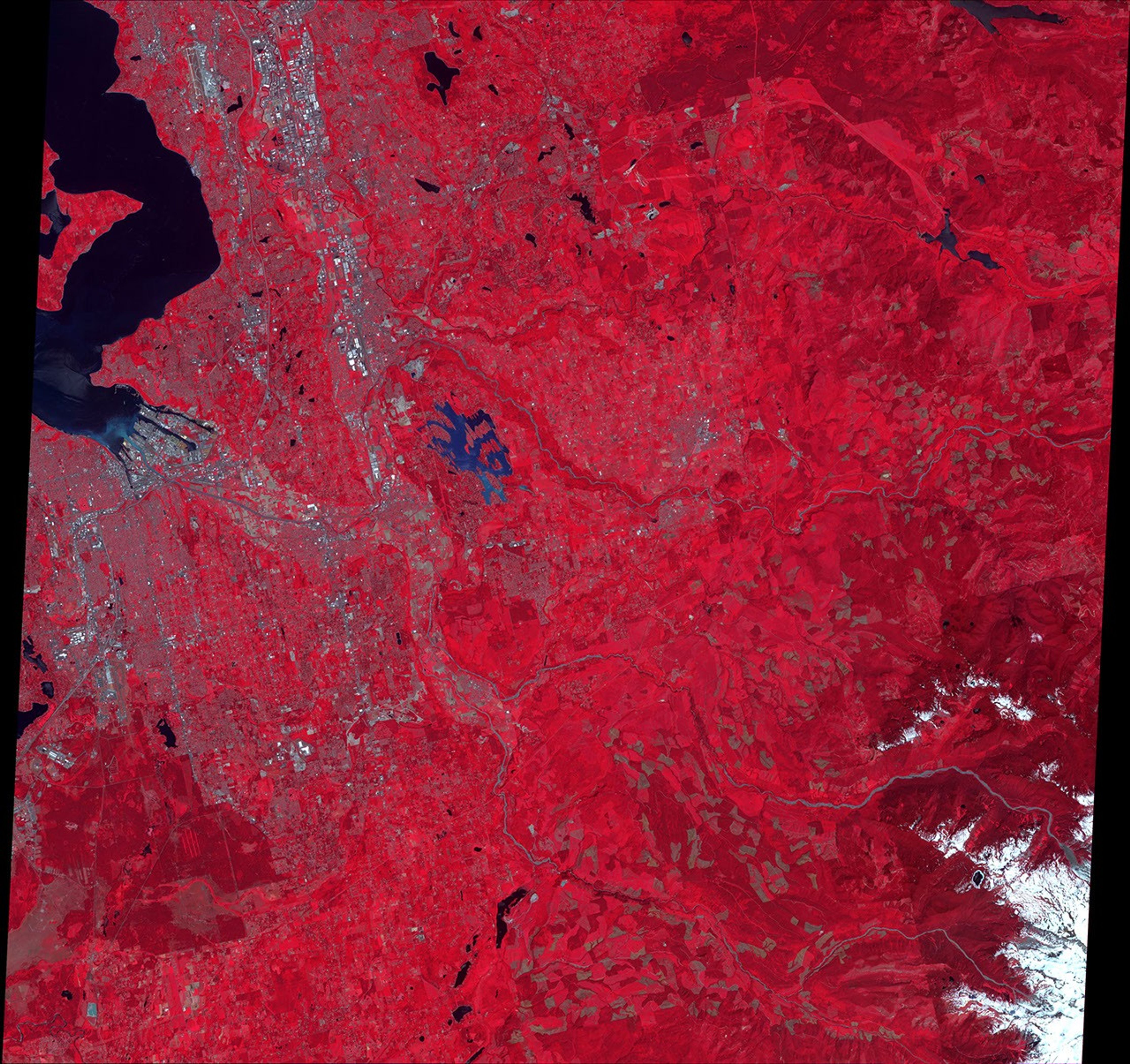
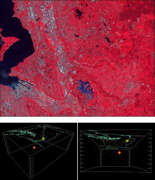
The epicenter of the quake was somewhere between Washington's capitalcity of Olympia and Tacoma. Tacoma is pictured in this false-colorcomposite image acquired by the Advanced Spaceborne Thermal Emission andReflection Radiometer (ASTER), flying aboard NASA's Terra satellite, on June 28,2000. Inthis scene, the dark and light red pixels show more or less vegetationon the surface. The light blue and grey pixels show areas of humandevelopment. The dark pixels in the upper lefthand corner of the imagerepresent the East Passage leading up into the Puget sound, in which thesouthern shoreline of Vashon Island can be seen. Just east of PugetSound, you can see the Sea-Tac Airport.
The two graphics beneath the ASTER image provide a three-dimensionalperspective on the earthquake's epicenter (orange ball), relative to thesurface. The blue contour lines represent geopolitical boundaries onthe surface. These graphics were generated using seismic data compiledby Paul Morin at the University of Minnesota.
References & Resources
Images courtesy NASA/GSFC/MITI/ERSDAC/JAROS,and U.S./Japan ASTER Science Team and Paul Morin, University of Minnesota.