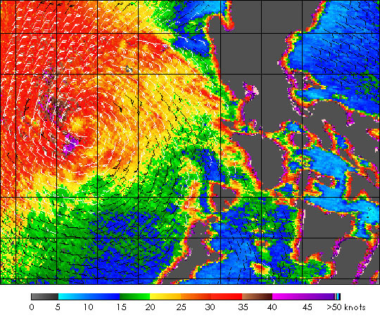
Shortly after passing through the Philippines, Tropical Storm Nepartak became Typhoon Nepartak. The SeaWinds scatterometer on the QuikSCATsatellite collected the data used to create this colorful image of Typhoon Nepartak on November 15,2003, as the storm began to strengthen. This image shows the near-surface winds 10 meters above the ocean. At this time, the winds near the center of the storm topped out at about 50 knots, 58 miles per hour, shown in dark purple. The barbs show the wind speed and direction at 25 kilometer resolution, the nominal QuikSCAT observation resolution. White barbs indicate areas of rain. The surface winds circle around the center of the storm to the left. The colored background shows the wind speed at 2.5 km resolution over a portion of the QuikSCAT swath.
References & Resources
This near-real-time image was produced at JPL by Thomas J. Fouser (NASA JPL) and David G. Long (Brigham Young University)