Suggested Searches

1 min read

Tropical Cyclone Monty

Instruments:
Tropical Cyclone Monty
March 2, 2004

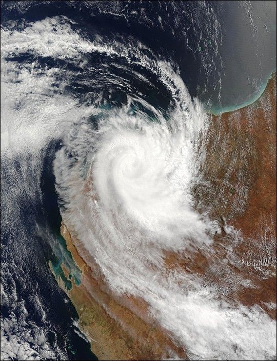
The MODIS instrument onboard NASA’s Terra satellite captured this true-color image of Tropical Cyclone Monty located 140 miles east of Learmonth, Australia on March 2, 2004. Since moving inland the storm has diminished in strength and now has maximum sustained winds of 75 mph. As of March 2, Monty has dumped over 8 inches of rain in Western Australia. According to the Joint Typhoon Warning Center, Monty is expected to continue moving poleward and quickly dissipate.

References & Resources

Image courtesy Jacques Descloitres, MODIS Land Rapid Response Team at NASA GSFC.

You may also be interested in:

Stay up-to-date with the latest content from NASA as we explore the universe and discover more about our home planet.

Ragasa Steers Toward China
3 min read

The super typhoon headed for Guangdong province after lashing Taiwan and northern Luzon in the Philippines.

Article
A Second Cyclone Slams Madagascar
3 min read

Widespread flooding affected tens of thousands of people after cyclones Fytia and Gezani drenched the island.

Article
Imelda and Humberto Crowd the Atlantic
3 min read

The tropical cyclones are close enough in proximity that they may influence one another.

Article